Riverton Regional Airport
| Riverton Regional Airport | |||||||||||||||
|---|---|---|---|---|---|---|---|---|---|---|---|---|---|---|---|
 |
|||||||||||||||
| Summary | |||||||||||||||
| Airport type | Public | ||||||||||||||
| Owner | City of Riverton | ||||||||||||||
| Serves | Riverton, Wyoming | ||||||||||||||
| Elevation AMSL | 5,528 ft / 1,685 m | ||||||||||||||
| Coordinates | 43°03′51″N 108°27′35″W / 43.06417°N 108.45972°WCoordinates: 43°03′51″N 108°27′35″W / 43.06417°N 108.45972°W | ||||||||||||||
| Website | http://flyriverton.com/ | ||||||||||||||
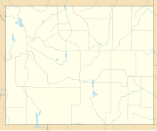
| Map | |||||||||||||||
| Location of airport in Wyoming / United States | |||||||||||||||
| Runways | |||||||||||||||
|
|||||||||||||||
| Statistics (2011) | |||||||||||||||
|
|||||||||||||||
|
Source: Federal Aviation Administration
|
|||||||||||||||
| Aircraft operations | 6,690 |
|---|---|
| Based aircraft | 45 |
Riverton Regional Airport (IATA: RIW, ICAO: KRIW, FAA LID: RIW) is a city owned, public use airport located three nautical miles (6 km) northwest of the central business district of Riverton, a city in Fremont County, Wyoming, United States. The airfield also serves nearby Lander, Wyoming with regard to scheduled passenger airline flights. It is mostly used for general aviation, but is also served by two commercial passenger airlines. Service was subsidized by the Essential Air Service program until October 2006, when Great Lakes Airlines began providing subsidy-free service.Key Lime Air operating as the Denver Air Connection began serving the airport with regional jet aircraft on July 1, 2016.
As per Federal Aviation Administration records, the airport had 17,035 passenger boardings (enplanements) in calendar year 2008, 14,186 enplanements in 2009, and 14,361 in 2010. It is included in the National Plan of Integrated Airport Systems for 2011–2015, which categorized it as a primary commercial service airport (more than 10,000 enplanements per year).
...
Wikipedia


