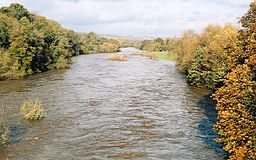
River Wye, Wales
| River Wye (Afon Gwy) | |
| River | |
|
The Wye at Hay-on-Wye
|
|
| Countries | Wales, England |
|---|---|
| Tributaries | |
| - left | River Lugg, Bachawy, Afon Edw, more |
| - right | River Trothy, River Monnow, Dulas Brook, more |
| Source | |
| - location | Plynlimon |
| - elevation | 690 m (2,264 ft) |
| - coordinates | 52°28′5.170″N 3°45′56.282″W / 52.46810278°N 3.76563389°W |
| Mouth | |
| - location | Chepstow, Severn Estuary |
| - elevation | 0 m (0 ft) |
| - coordinates | 51°36′36.086″N 2°39′42.423″W / 51.61002389°N 2.66178417°WCoordinates: 51°36′36.086″N 2°39′42.423″W / 51.61002389°N 2.66178417°W |
| Length | 215 km (134 mi) |
| Basin | 4,136 km2 (1,597 sq mi) |
| Site of Special Scientific Interest | |
| Grid reference | ST544912 to SO230429 |
|---|---|
| Interest | Biological/Geological |
| Area | England: 1,159.6 ha (2,865 acres) Wales: 245.2 ha (606 acres) Total: 1,404.8 ha (3,471 acres) |
| Notification | 1978 |
| Natural England website | |
The River Wye (Welsh: Afon Gwy) is the fifth-longest river in the UK, stretching some 215 kilometres (134 miles) from its source on Plynlimon in mid Wales to the Severn estuary. For much of its length the river forms part of the border between England and Wales. The Wye Valley (lower part) is an Area of Outstanding Natural Beauty. The Wye is important for nature conservation and recreation.
The Wye's Latin name is Vaga, an adjective meaning 'wandering'. The Tithe map references a Vagas Field in both Whitchurch and Chepstow. The modern Welsh name Gwy may be derived from old Welsh Gwybiol or Gwyr (crooked wandering hills).
The source of the Wye is in the Welsh mountains at Plynlimon. It flows through or past several towns and villages including Rhayader, Builth Wells, Hay-on-Wye, Hereford (the only city on the River Wye), Ross-on-Wye, Symonds Yat, Monmouth and Tintern, meeting the Severn estuary just below Chepstow. Its total length is 134 miles (216 km). The lower 16 miles (26 km) of the river from Redbrook to Chepstow forms the border between England and Wales.
...
Wikipedia

