River Ouse (Yorkshire)
|
River Ouse |
|
|
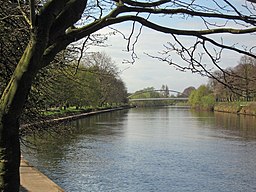
The River Ouse in York
|
|
| Country | England |
|---|---|
| County | Yorkshire |
| Source | River Ure |
| - location | Cuddy Shaw Reach, near Linton-on-Ouse |
| - elevation | 10 m (33 ft) |
| - coordinates | 54°2′4″N 1°16′30″W / 54.03444°N 1.27500°W |
| Mouth | Humber Estuary |
| - location | Trent Falls |
| - elevation | 0 m (0 ft) |
| - coordinates | 53°42′8″N 0°41′46″W / 53.70222°N 0.69611°WCoordinates: 53°42′8″N 0°41′46″W / 53.70222°N 0.69611°W |
| Length | 84 km (52 mi) |
| Basin | 10,704 km2 (4,133 sq mi) |
| Discharge | for Skelton |
| - average | 51.2 m3/s (1,808 cu ft/s) |
|
River Ouse catchment
|
|
The River Ouse (/ˈuːz/ OOZ) is a river in North Yorkshire, England. Hydrologically the river is a continuation of the River Ure, and the combined length of the River Ure and River Ouse makes it, at 129 miles (208 km), the sixth longest river of the United Kingdom and (including the Ure) the longest to flow entirely in one county. The length of the Ouse alone is about 52 miles (84 km).
The river is formed at the confluence of the River Ure and the much smaller Ouse Gill Beck at Cuddy Shaw Reach near Linton-on-Ouse, about six miles downstream of the confluence of the River Swale with the River Ure. It then flows through the city of York and the towns of Selby and Goole before joining with the River Trent at Trent Falls, near the village of Faxfleet, to form the Humber Estuary.
The Ouse's system of tributaries (which includes the Derwent, Aire, Don, Wharfe, Rother, Nidd, Swale, Ure, and Foss) drains a large upland area of northern England, including much of the Yorkshire Dales and North York Moors.
...
Wikipedia


