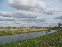
River Little Ouse
| River Little Ouse | |
| River | |
|
The river north of Lakenheath
|
|
| Country | England |
|---|---|
| Counties | Norfolk, Suffolk |
| Tributaries | |
| - left | Black Bourn, Lakenheath Lode |
| - right | River Thet |
| Source | |
| - location | Thelnetham, Norfolk/Suffolk border |
| - elevation | 25 m (82 ft) |
| - coordinates | 52°22′16″N 0°59′39″E / 52.37124°N 0.99405°E |
| Mouth | Brandon Creek |
| - location | Littleport, Cambridgeshire |
| - elevation | 0 m (0 ft) |
| - coordinates | 52°30′04″N 0°22′01″E / 52.50121°N 0.36704°ECoordinates: 52°30′04″N 0°22′01″E / 52.50121°N 0.36704°E |
| Length | 37 mi (60 km) |
|
Little Ouse (light blue) and Great Ouse (dark)
|
|
| River Little Ouse | |||||||||||||||||||||||||||||||||||||||||||||||||||||||||||||||||||||||||||||||||||||||||||||||||||||||||||||||||||||||||||||||||||||||||||||||||||||||||||||||||||||||||||||||||||||||||||||||||||
|---|---|---|---|---|---|---|---|---|---|---|---|---|---|---|---|---|---|---|---|---|---|---|---|---|---|---|---|---|---|---|---|---|---|---|---|---|---|---|---|---|---|---|---|---|---|---|---|---|---|---|---|---|---|---|---|---|---|---|---|---|---|---|---|---|---|---|---|---|---|---|---|---|---|---|---|---|---|---|---|---|---|---|---|---|---|---|---|---|---|---|---|---|---|---|---|---|---|---|---|---|---|---|---|---|---|---|---|---|---|---|---|---|---|---|---|---|---|---|---|---|---|---|---|---|---|---|---|---|---|---|---|---|---|---|---|---|---|---|---|---|---|---|---|---|---|---|---|---|---|---|---|---|---|---|---|---|---|---|---|---|---|---|---|---|---|---|---|---|---|---|---|---|---|---|---|---|---|---|---|---|---|---|---|---|---|---|---|---|---|---|---|---|---|---|---|
| |||||||||||||||||||||||||||||||||||||||||||||||||||||||||||||||||||||||||||||||||||||||||||||||||||||||||||||||||||||||||||||||||||||||||||||||||||||||||||||||||||||||||||||||||||||||||||||||||||


