River Hull
| River Hull | |
|
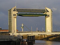
The tidal barrier at the mouth of the river
|
|
| Country | England |
|---|---|
| County | East Riding of Yorkshire |
| Source | |
| - location | Driffield |
| - elevation | 65 ft (20 m) |
| Mouth | Humber estuary |
| - location | Kingston upon Hull |
| - elevation | 0 ft (0 m) |
| - coordinates | 53°44′20.17″N 0°19′52.3″W / 53.7389361°N 0.331194°W |
| Discharge | for Hempholme Lock |
| - average | 3.4 m3/s (120 cu ft/s) |
|
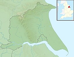
Mouth of the river shown within the East Riding of Yorkshire
|
|
| River Hull | ||||||||||||||||||||||||||||||||||||||||||||||||||||||||||||||||||||||||||||||||||||||||||||||||||||||||||||||||||||||||||||||||||||||||||||||||||||||||||||||||||||||||||||||||||||||||||||||||||||||||
|---|---|---|---|---|---|---|---|---|---|---|---|---|---|---|---|---|---|---|---|---|---|---|---|---|---|---|---|---|---|---|---|---|---|---|---|---|---|---|---|---|---|---|---|---|---|---|---|---|---|---|---|---|---|---|---|---|---|---|---|---|---|---|---|---|---|---|---|---|---|---|---|---|---|---|---|---|---|---|---|---|---|---|---|---|---|---|---|---|---|---|---|---|---|---|---|---|---|---|---|---|---|---|---|---|---|---|---|---|---|---|---|---|---|---|---|---|---|---|---|---|---|---|---|---|---|---|---|---|---|---|---|---|---|---|---|---|---|---|---|---|---|---|---|---|---|---|---|---|---|---|---|---|---|---|---|---|---|---|---|---|---|---|---|---|---|---|---|---|---|---|---|---|---|---|---|---|---|---|---|---|---|---|---|---|---|---|---|---|---|---|---|---|---|---|---|---|---|---|---|---|
| ||||||||||||||||||||||||||||||||||||||||||||||||||||||||||||||||||||||||||||||||||||||||||||||||||||||||||||||||||||||||||||||||||||||||||||||||||||||||||||||||||||||||||||||||||||||||||||||||||||||||


