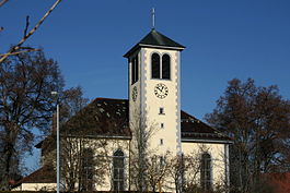
Rietheim, Switzerland
| Rietheim | ||
|---|---|---|
 |
||
|
||
| Coordinates: 47°36′N 8°17′E / 47.600°N 8.283°ECoordinates: 47°36′N 8°17′E / 47.600°N 8.283°E | ||
| Country | Switzerland | |
| Canton | Aargau | |
| District | Zurzach | |
| Area | ||
| • Total | 3.93 km2 (1.52 sq mi) | |
| Elevation | 331 m (1,086 ft) | |
| Population (Dec 2015) | ||
| • Total | 739 | |
| • Density | 190/km2 (490/sq mi) | |
| Postal code | 5323 | |
| SFOS number | 4316 | |
| Surrounded by | Klingnau, Koblenz, Küssaberg (DE-BW), Zurzach | |
| Website |
www SFSO statistics |
|
Rietheim is a municipality in the district of Zurzach in the canton of Aargau in Switzerland.
Rietheim is first mentioned in 1239 as Riethein. In the 13th Century the noble family of Rietheim is mentioned. The village belonged to the court of Klingnau, which from 1415 until 1798 was under the high court of Baden. The low court right lay with the Bishop of Constance and was exercised by Zurzach Abbey. During the Protestant Reformation the majority of the citizens converted of the new faith.
In 1915 the Swiss Sodafabrik (renamed Solvay in 1922) was awarded a concession for the exploitation of salt in the Rietheimerfeld. The project was abandoned in the early 1960s because of severe land subsidence. Since 1876 it was given a railroad station and connected to the Koblenz-Winterthur line. In 1977 a new schoolhouse was built for the lower grades.
The village was formerly dominated by agriculture and viticulture, but at the beginning of the 21st Century, it became a residential and commuter town. Many of Rietheim's various community functions (including finance, education, sanitation) are shared with Zurzach.
Rietheim has an area, as of 2009[update], of 3.93 square kilometers (1.52 sq mi). Of this area, 1.83 km2 (0.71 sq mi) or 46.6% is used for agricultural purposes, while 1.55 km2 (0.60 sq mi) or 39.4% is forested. Of the rest of the land, 0.33 km2 (0.13 sq mi) or 8.4% is settled (buildings or roads), 0.19 km2 (0.073 sq mi) or 4.8% is either rivers or lakes and 0.03 km2 (7.4 acres) or 0.8% is unproductive land.
...
Wikipedia


