Richboro, Pennsylvania
| Richboro | |
| Census-designated place | |
| Country | United States |
|---|---|
| State | Pennsylvania |
| County | Bucks |
| Township | Northampton |
| Elevation | 262 ft (79.9 m) |
| Coordinates | 40°15′18″N 75°00′22″W / 40.25500°N 75.00611°WCoordinates: 40°15′18″N 75°00′22″W / 40.25500°N 75.00611°W |
| Area | 4.4 sq mi (11.4 km2) |
| - land | 4.4 sq mi (11 km2) |
| - water | 0.0 sq mi (0 km2), 0% |
| Population | 6,563 (2010) |
| Density | 1,491.6/sq mi (575.9/km2) |
| Timezone | EST (UTC-5) |
| - summer (DST) | EDT (UTC-4) |
| ZIP code | 18954 |
| Area code | 215 |
|
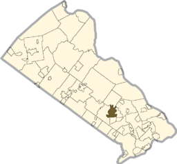
Location of Richboro in Bucks County
|
|
Richboro is a census-designated place (CDP) in Northampton Township, Bucks County, Pennsylvania, United States. The population was 6,563 at the 2010 census.
Hampton Hill, John Thompson House, Twin Trees Farm, and Willow Mill Complex are listed on the National Register of Historic Places.
Richboro is located at 40°13′18″N 75°0′22″W / 40.22167°N 75.00611°W (40.221658, -75.006047).
According to the United States Census Bureau, the CDP has a total area of 4.4 square miles (11 km2), all of it land.
As of the census of 2000, there were 6,678 people, 2,062 households, and 1,864 families residing in the CDP. The population density was 1,524.5 people per square mile (588.7/km²). There were 2,072 housing units at an average density of 473.0/sq mi (182.6/km²). The racial makeup of the CDP was 97.09% White, 0.36% African American, 1.81% Asian, 0.01% from other races, and 0.72% from two or more races. Hispanic or Latino of any race were 0.63% of the population.
...
Wikipedia


