Rehoboth, Massachusetts
| Rehoboth, Massachusetts | ||
|---|---|---|
| Town | ||

Goff Memorial Hall
|
||
|
||
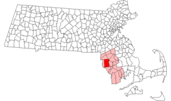
 Location in Bristol County in Massachusetts |
||
| Coordinates: 41°50′25″N 71°15′00″W / 41.84028°N 71.25000°WCoordinates: 41°50′25″N 71°15′00″W / 41.84028°N 71.25000°W | ||
| Country | United States | |
| State | Massachusetts | |
| County | Bristol | |
| Settled | 1636 | |
| Incorporated | 1643 | |
| Government | ||
| • Type | Open town meeting | |
| Area | ||
| • Total | 46.8 sq mi (121.1 km2) | |
| • Land | 46.5 sq mi (120.4 km2) | |
| • Water | 0.3 sq mi (0.7 km2) | |
| Elevation | 50 ft (15 m) | |
| Population (2010) | ||
| • Total | 11,608 | |
| • Density | 250/sq mi (96/km2) | |
| Time zone | Eastern (UTC-5) | |
| • Summer (DST) | Eastern (UTC-4) | |
| ZIP code | 02769 | |
| Area code(s) | 508 / 774 | |
| FIPS code | 25-56375 | |
| GNIS feature ID | 0619437 | |
| Website | http://www.town.rehoboth.ma.us/ | |
Rehoboth is a historic town in Bristol County, Massachusetts, United States. Established in 1643, Rehoboth is one of the oldest towns in Massachusetts. The population was 11,608 at the 2010 census. Rehoboth is a mostly rural, suburban community with many historic sites including 53 historic cemeteries.
Rehoboth was established in 1643, originally by Walter Palmer (born 1585) and William Sabin, it was incorporated in 1645, one of the earliest Massachusetts towns to incorporate. The town is named for the Hebrew word for "enlargement," (Broad Places) signifying the space settlers enjoyed.(God has given us room)
Early Rehoboth, known as "Old Rehoboth," included all of what is now Seekonk, Massachusetts, and East Providence, Rhode Island, as well as parts of the nearby communities of Attleboro, North Attleborough, Swansea and Somerset in Massachusetts, and Barrington, Bristol, Warren, Pawtucket, Cumberland, and Woonsocket in Rhode Island. The town was and still is a site of a crossroads which help to serve Taunton, Providence, Fall River and points to the north.
...
Wikipedia

