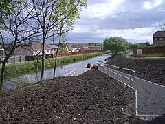
Redding, Falkirk
Redding
|
|
|---|---|
 Slipway to the Union Canal at Redding |
|
| Redding shown within the Falkirk council area | |
| Population | 1,954 (2001 census) |
| OS grid reference | NS923786 |
| • Edinburgh | 21.2 mi (34.1 km) ESE |
| • London | 343 mi (552 km) SSE |
| Civil parish | |
| Council area | |
| Lieutenancy area | |
| Country | Scotland |
| Sovereign state | United Kingdom |
| Post town | Falkirk |
| Postcode district | FK2 |
| Dialling code | 01324 |
| Police | Scottish |
| Fire | Scottish |
| Ambulance | Scottish |
| EU Parliament | Scotland |
| UK Parliament | |
| Scottish Parliament | |
| Website | falkirk.gov.uk |
Redding is a village within the Falkirk council area in Central Scotland. The village is 2.1 miles (3.4 km) southeast of Falkirk, 1.9 miles (3.1 km) south-southwest of Grangemouth and 1 mile (1.6 km) west of Polmont.
At the time of the 2001 census, Redding had a population of 1,954 residents.
On a hill beyond Redding is a stone that is called Wallace's stone, marking out the spot from which Sir William Wallace, after his quarrel with Sir John Stuart, one of the Scottish chiefs, is said to have viewed the Battle of Falkirk, from which he had been compelled to retire, and to have witnessed the defeat of the Scottish army.
In 1923, the small mining community of Redding was the scene of one of the worst disasters in the history of the Scottish coalfield, which claimed the lives of 40 men. At 5.00am on Tuesday 25 September 1923 an inrush of water flooded the pit. The Sir William Wallace Lodge of the Grand Lodge of Scotland Free Colliers still march every year on the first Saturday in August in memory of the men who lost their lives in the disaster.
...
Wikipedia

