Raton Pass
| Ratón Pass | |
|---|---|

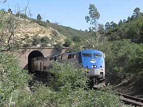
Amtrak's Southwest Chief westbound out of the Raton Tunnel near the summit of Raton Pass
|
|
| Elevation | 7,834 ft (2,388 m) |
| Traversed by |
Burlington Northern Santa Fe Railroad |
| Location | Colfax County, New Mexico and Las Animas County, Colorado, US |
| Coordinates | 36°59′28″N 104°29′12″W / 36.9911344°N 104.4866544°WCoordinates: 36°59′28″N 104°29′12″W / 36.9911344°N 104.4866544°W |
| Topo map |
Ratón |
|
Raton Pass
|
|

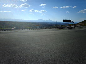
Looking into Colorado from Raton Pass
|
|
| Nearest city | Trinidad, CO, Raton, NM |
| Area | 1,520 acres (620 ha) |
| Built | 1866 |
| NRHP Reference # | 66000474 |
| CSRHP # | 5LA.2182 |
| Significant dates | |
| Added to NRHP | October 15, 1966 |
| Designated NHL | December 19, 1960 |
Ratón
Ratón Pass (7834 feet or 2388 meters elevation) is a mountain pass on the Santa Fe Trail along the Colorado-New Mexico border in the United States. Raton Pass is a federally designated National Historic Landmark. Ratón is Spanish for "mouse."
The pass is located on the eastern side of the Sangre de Cristo Mountains between Trinidad, Colorado and Raton, New Mexico, approximately 100 miles (160 km) northeast of Santa Fe. The pass crosses the line of volcanic mesas that extends east from the Sangre de Cristo Mountains along the state line, and furnishes the most direct land route between the valley of the Arkansas River to the north and the upper valley of the Canadian River, leading to Santa Fe, to the south.
In 1821, Captain William Becknell laid the path of the Santa Fe Trail through the pass. In 1846 during the Mexican–American War, Stephen W. Kearny and his troops passed through the pass en route to New Mexico. During the Civil War, it was the primary path into New Mexico since it avoided Confederate raiders. It was later developed into a toll road by Richens Lacey Wootton.
In the 20th century the Pass became the route of U.S. Route 85 and later Interstate 25 between Denver and Albuquerque. The road at the pass is at an elevation of 7834 feet above sea level, and therefore is subject to difficult driving during heavy winter snowfalls
...
Wikipedia


