Rapid City Regional Airport
| Rapid City Regional Airport | |||||||||||||||
|---|---|---|---|---|---|---|---|---|---|---|---|---|---|---|---|
| Summary | |||||||||||||||
| Airport type | Public | ||||||||||||||
| Owner | City of Rapid City | ||||||||||||||
| Operator | Rapid City Regional Airport Board | ||||||||||||||
| Serves | Rapid City, South Dakota | ||||||||||||||
| Elevation AMSL | 3,204 ft / 977 m | ||||||||||||||
| Coordinates | 44°02′43″N 103°03′26″W / 44.04528°N 103.05722°W | ||||||||||||||
| Website | RCgov.org/Airport/... | ||||||||||||||
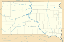
| Map | |||||||||||||||
| Location of airport in South Dakota/United States | |||||||||||||||
| Runways | |||||||||||||||
|
|||||||||||||||
| Statistics | |||||||||||||||
|
|||||||||||||||
|
Source: Federal Aviation Administration
|
|||||||||||||||
| Aircraft operations (2011) | 39,876 |
|---|---|
| Based aircraft (2016) | 111 |
Rapid City Regional Airport (IATA: RAP, ICAO: KRAP, FAA LID: RAP) is a public use airport, nine miles southeast of Rapid City, in Pennington County, South Dakota.
The airport covers 1,655 acres (670 ha) at an elevation of 3,204 feet (977 m). It has two runways: 14/32 is 8,701 by 150 feet (2,652 x 46 m) concrete and 5/23 is 3,601 by 75 feet (1,098 x 23 m) asphalt.
In 2007 the airport had 47,844 aircraft operations, average 131 per day: 60% general aviation, 26% air taxi, 8% military and 5% airline. In November 2016, there were 111 aircraft based at this airport: 70 single-engine, 31 multi-engine, 8 jet, 1 helicopter and 1 glider.
The terminal building opened in 1988; a $20.5 million expansion and renovation designed by TSP Architecture was completed in 2012. It includes 12,000 square feet of new floor space, the addition of three jet bridges and one boarding gate, an expanded security area with room for up to three lanes and body scanners, a new rental car wing, additional seating in the concourse, larger restrooms before and after security, modernized phone and data systems, new flight information boards, improved food service and shopping areas in the concourse, a rooftop patio, and energy-efficient windows and building exterior repair.
...
Wikipedia


