Rangárþing eystra
| Rangárþing eystra | |
|---|---|

Coat of arms of Rangárþing eystra
|
|

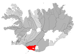
Location of Rangárþing eystra
|
|
| Region | Southern Region |
| Constituency | South Constituency |
| Manager | Ísólfur Gylfi Pálmason |
| Area | 1,841 km2 (711 sq mi) |
| Population | 1,708 |
| Density | 0.93/km2 (2.4/sq mi) |
| Municipal number | 8613 |
| Postal code(s) | 860, 861 |
| Website | hvolsvollur |
Rangárþing eystra is a municipality located in southern Iceland in the Southern Region, between Eystri Rangá in the west and Jökulsá á Sólheimasandi in the east. The largest settlements are Skógar and Hvolsvöllur.
Coordinates: 63°45′00″N 20°14′02″W / 63.750°N 20.234°W
...
Wikipedia
