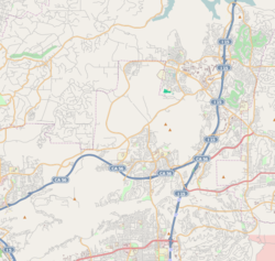
Rancho Bernardo, San Diego, California
| Rancho Bernardo, San Diego | |
|---|---|
| Community of San Diego | |
| Rancho Bernardo | |
| Nickname(s): RB | |
 Rancho Bernardo and neighborhood boundaries |
|
| Location within Northeastern San Diego | |
| Coordinates: 33°01′15″N 117°04′44″W / 33.020842°N 117.078903°W | |
| Country | |
| State |
|
| County |
|
| City |
|
Coordinates: 33°01′15.03″N 117°04′44.05″W / 33.0208417°N 117.0789028°W
Rancho Bernardo is a master-planned community in the northern hills of the city of San Diego, California.
The topography of Rancho Bernardo consists of canyons and rolling hills. It is a sprawling community, with shopping malls, golf courses and office parks typical of San Diego development.
The community is located about 20 miles (32 km) north-north-east of downtown San Diego, immediately east of 4S Ranch, north of Carmel Mountain Ranch, northwest of the city of Poway and south of Escondido.
Rancho Bernardo is located on the Rancho San Bernardo Mexican land grant made in 1842.
In the 1960s, Rancho Bernardo was annexed by San Diego. The area was developed by AVCO Community Developers.
On October 22, 2007, the Witch Creek Fire burned through Rancho Bernardo and several other populous areas of San Diego County, destroying hundreds of houses, and completely destroying several entire neighborhoods, particularly ones that firefighters had trouble accessing due to rugged terrain and rapidly advancing flames pushed by strong Santa Ana winds.The highly unpredictable flames pushed into the northeast section of Poway during the day, prompting evacuation of Palomar-Pomerado Hospital. The neighborhoods of the Trails, Montelena and Westwood were the main areas hit in Rancho Bernardo.
...
Wikipedia

