Ragland, Alabama
| Ragland, Alabama | |
|---|---|
| Town | |
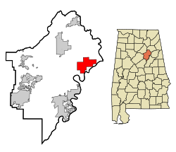
 Location in St. Clair County and the state of Alabama |
|
| Coordinates: 33°44′36″N 86°8′32″W / 33.74333°N 86.14222°W | |
| Country | United States |
| State | Alabama |
| County | St. Clair |
| Area | |
| • Total | 16.9 sq mi (43.7 km2) |
| • Land | 16.8 sq mi (43.4 km2) |
| • Water | 0.1 sq mi (0.3 km2) |
| Elevation | 561 ft (171 m) |
| Population (2010) | |
| • Total | 1,639 |
| • Density | 113.5/sq mi (43.9/km2) |
| Time zone | Central (CST) (UTC−6) |
| • Summer (DST) | CDT (UTC−5) |
| ZIP code | 35131 |
| Area code | 205 |
| FIPS code | 01-63216 |
| GNIS feature ID | 0164825 |
Ragland is a town in St. Clair County, Alabama, United States southeast of Ashville. It incorporated in 1899. At the 2010 census the population was 1,639, down from 1,918 in 2000. It is part of the Birmingham-Hoover-Cullman Combined Statistical Area.
An F4 tornado struck from the southwest on Palm Sunday, March 27, 1994 at 10:55 a.m. At 11:27 a.m., the National Weather Service of Birmingham issued a tornado warning for northern Calhoun, southeastern Etowah, and southern Cherokee counties. Twelve minutes later, the tornado destroyed Piedmont's Goshen United Methodist Church.
Ragland is located at 33°44′36″N 86°8′32″W / 33.74333°N 86.14222°W (33.743415, -86.142268).
According to the U.S. Census Bureau, the town has a total area of 16.9 square miles (44 km2), of which 16.8 square miles (44 km2) is land and 0.1 square miles (0.26 km2) (0.71%) is water.
As of the census of 2000, there were 1,918 people, 729 households, and 567 families residing in the town. The population density was 114.5 people per square mile (44.2/km²). There were 840 housing units at an average density of 50.1 per square mile (19.4/km²). The racial makeup of the town was 82.17% White, 17.00% Black or African American, 0.05% Native American, 0.05% Asian, 0.10% from other races, and 0.63% from two or more races.
...
Wikipedia
