RAF Wick
| Wick Airport | |||||||||||
|---|---|---|---|---|---|---|---|---|---|---|---|

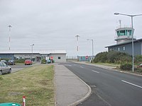
Wick Airport terminal
|
|||||||||||
| Summary | |||||||||||
| Airport type | Private | ||||||||||
| Owner/Operator | Highlands and Islands Airports Limited | ||||||||||
| Serves | Wick, Highland | ||||||||||
| Location | Wick, Highland | ||||||||||
| Elevation AMSL | 126 ft / 38 m | ||||||||||
| Coordinates | 58°27′32″N 003°05′35″W / 58.45889°N 3.09306°WCoordinates: 58°27′32″N 003°05′35″W / 58.45889°N 3.09306°W | ||||||||||
| Website | Wick Airport | ||||||||||
| Map | |||||||||||
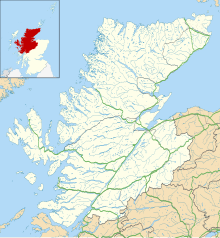
| Location in Highland | |||||||||||
| Runways | |||||||||||
|
|||||||||||
| Statistics (2016) | |||||||||||
|
|||||||||||
| Passengers | 20,158 |
|---|---|
| Passenger change 15–16 |
|
| Aircraft Movements | 4,427 |
| Movements change 15–16 |
|
Wick Airport (IATA: WIC, ICAO: EGPC) is located 1 nautical mile (1.9 km; 1.2 mi) north of the town of Wick in Caithness at the north-eastern extremity of the mainland of Scotland. It is owned and maintained by Highlands and Islands Airports Limited.
The airport provides air travel connections for Caithness, with scheduled services to Aberdeen Airport and Edinburgh Airport. It is also regularly used by helicopters servicing local offshore oil operations, and as a stop-over by light aircraft ferry flights between Europe and North America via Iceland.
The airport is marketed as Wick John O' Groats by FlyBe, which operates a daily service (excluding Saturdays) to Edinburgh, using its franchise partner Loganair.
Wick was originally a grass airfield, used by Captain E. E. Fresson's Highland Airways Ltd. (later Scottish Airways Ltd.) from 1933 until 1939.
Requisitioned by the Air Ministry during World War II, the airfield was extended with hard runways, hangars, and other buildings. The airfield was administered by No. 18 Group, RAF Coastal Command. A satellite airfield existed at RAF Skitten.
On 21 May 1941, a photographic reconnaissance Supermarine Spitfire piloted by Flying Officer Michael F. Suckling took off from Wick, and flew to Norway, in search of the German battleship Bismarck. If Bismarck was to break out into the North Atlantic, she would present a significant risk to the ships supplying Britain. 320 miles to the east of Wick, F/O Suckling found and photographed her, hiding in Grimstadfjord. This information enabled the Royal Navy to order HMS Hood and other ships, as well as aircraft, to take positions intended to track Bismarck, and prevent her from entering the North Atlantic. In ensuing battles, Hood was sunk, and, later, Bismarck. German battleships and battle cruisers never again entered the North Atlantic.
...
Wikipedia

