RAF Waddington
| RAF Waddington | |||||||
|---|---|---|---|---|---|---|---|
| Near Waddington, Lincolnshire in England | |||||||

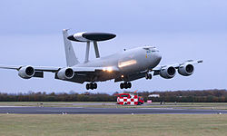
E-3D Sentry Aircraft Lands at RAF Waddington
|
|||||||

"Your Faith and Freedom"
|
|||||||
|
Shown within Lincolnshire
|
|||||||
| Coordinates | 53°10′21″N 000°31′51″W / 53.17250°N 0.53083°WCoordinates: 53°10′21″N 000°31′51″W / 53.17250°N 0.53083°W | ||||||
| Type | Royal Air Force station | ||||||
| Site information | |||||||
| Owner | Ministry of Defence | ||||||
| Operator | Royal Air Force | ||||||
| Website | www |
||||||
| Site history | |||||||
| Built | 1916 | ||||||
| In use | 1916–1920 1937–present |
||||||
| Garrison information | |||||||
| Current commander |
Group Captain R P Barrow OBE RAF | ||||||
| Occupants |
|
||||||
| Airfield information | |||||||
| Identifiers | IATA: WTN, ICAO: EGXW | ||||||
| Elevation | 70 metres (230 ft) AMSL | ||||||
|
|||||||
| Waddington International Air Show | |
|---|---|

Waddington Air Show in 2002 with the Air Warfare Centre in the distance
|
|
| Genre | Air show |
| Dates | July |
| Venue | RAF Waddington |
| Country | U.K. |
| Established | 1995 |
| Attendance | 140,000 |
Royal Air Force Waddington or more simply RAF Waddington (IATA: WTN, ICAO: EGXW) is a Royal Air Force station located 4.2 miles (6.8 km) south of Lincoln, Lincolnshire and 13.3 miles (21.4 km) north east of Newark-on-Trent, Nottinghamshire, England. The site is owned by the Ministry of Defence and managed by the RAF.
The station badge depicts Lincoln Cathedral rising through the clouds.
Waddington opened as a Royal Flying Corps flying training station in 1916, they taught many pilots, including members of the American army, teaching students to fly a variety of aircraft and was transferred to the Royal Air Force on 1 April 1918 operating until 1920, when the station went into care and maintenance.
Squadrons operating during this time:
As part of the pre-war expansion programme the Waddington site was earmarked for development into a fully equipped Bomber Station. As it developed, RAF Waddington made an increasingly dramatic imposition on the surrounding rural landscape such as to the Lincolnshire Edge, a Jurassic limestone ridge, which forms the distinctive backbone of the county from Whitton on the Humber Estuary in the north, down to Grantham in the south. Along the top of the Edge a series of airfields were developed, including RAF Waddington, RAF Cranwell and RAF Scampton. They lie within an open landscape, consisting of rectilinear fields and few boundaries.
...
Wikipedia

