RAF Snaith
|
RAF Snaith |
|||||||||||||||||||
|---|---|---|---|---|---|---|---|---|---|---|---|---|---|---|---|---|---|---|---|
| Summary | |||||||||||||||||||
| Airport type | Military | ||||||||||||||||||
| Owner | Air Ministry | ||||||||||||||||||
| Operator | Royal Air Force | ||||||||||||||||||
| Location | Snaith | ||||||||||||||||||
| Built | 1940 | ||||||||||||||||||
| In use | 1941-1946 | ||||||||||||||||||
| Elevation AMSL | 43 ft / 13 m | ||||||||||||||||||
| Coordinates | 53°40′53″N 001°05′00″W / 53.68139°N 1.08333°WCoordinates: 53°40′53″N 001°05′00″W / 53.68139°N 1.08333°W | ||||||||||||||||||
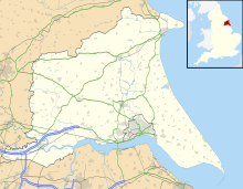
| Map | |||||||||||||||||||
| Location in East Riding of Yorkshire | |||||||||||||||||||
| Runways | |||||||||||||||||||
|
|||||||||||||||||||
Royal Air Force Snaith or RAF Snaith is a former Royal Air Force station which was located 7 miles (11 km) south west of Goole, Yorkshire, England and close to the village of Pollington.
The airfield opened 1941 before closing in 1946.
A large number of different squadrons used the airfield firstly No. 150 Squadron RAF flew Vickers Wellingtons between July 1941 and October 1942 before moving to RAF Kirmington, then being replaced by No. 51 Squadron RAF from October 1942 until May 1945 using the Handley Page Halifax. During this period the airfield also had another squadron join as a flight from No.51 Sqn RAF turned its aircraft and crew over to make another squadron which was No. 578 Squadron RAF which flew from the airfield temporarily between January 1944 until February 1944 before moving to the empty RAF Burn.
A number of units also used the airfield such as No 6266 Servicing Echelon between 27 April 1944 and 6 May 1944 repairing the various aircraft and No. 17 Air Crew Holding Unit between 20 June 1945 and 27 May 1946. During this time a small Beam Approach Flight using Airspeed Oxfords used the airfield for a short period learning beam approach landings.
During the construction of the M62 motorway the airfield was cut in half with the motorway going east to west through the top third of the airfield. However a number of technical buildings are still in place including the sergeants mess.
...
Wikipedia

