RAF Duxford
|
Duxford Aerodrome Royal Air Force Duxford USAAF Station 357 
|
|||||||||||||||
|---|---|---|---|---|---|---|---|---|---|---|---|---|---|---|---|

Duxford - 9 July 1946
|
|||||||||||||||
| Summary | |||||||||||||||
| Airport type | Private-owned, Public-use | ||||||||||||||
| Owner | Imperial War Museum & Cambridgeshire County Council | ||||||||||||||
| Operator | Imperial War Museum | ||||||||||||||
| Serves | Imperial War Museum Duxford | ||||||||||||||
| Location | Duxford | ||||||||||||||
| Elevation AMSL | 125 ft / 38 m | ||||||||||||||
| Coordinates | 52°05′27″N 000°07′55″E / 52.09083°N 0.13194°ECoordinates: 52°05′27″N 000°07′55″E / 52.09083°N 0.13194°E | ||||||||||||||
| Website | Flying at Duxford | ||||||||||||||
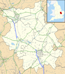
| Map | |||||||||||||||
| Location in Cambridgeshire | |||||||||||||||
| Runways | |||||||||||||||
|
|||||||||||||||
Duxford Aerodrome (ICAO: EGSU) is located 8 nautical miles (15 km; 9.2 mi) south of Cambridge, within the Parish of Duxford, Cambridgeshire, England and nearly 1-mile (1.6 km) west of the village.
The airfield is owned by the Imperial War Museum (IWM) and is the site of the Imperial War Museum Duxford and the American Air Museum.
Duxford Aerodrome has a Civil Aviation Authority (CAA) Ordinary Licence (Number P678) that allows flights for the public transport of passengers or for flying instruction as authorised by the licensee (Cambridgeshire County Council). The aerodrome is not licensed for night use.
Duxford airfield dates to 1918 when many of the buildings were constructed by German prisoner-of-war labour. The airfield housed 8 Squadron in 1919–1920 which was equipped with Bristol Fighters. The airfield was then used by No. 2 Flying Training School RAF until April 1923, when 19 Squadron was formed at Duxford with Sopwith Snipes.
...
Wikipedia

