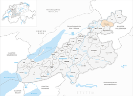
Rüti bei Büren
| Rüti bei Büren | ||
|---|---|---|

Rüti bei Büren's Reformed Church
|
||
|
||
| Coordinates: 47°9′N 7°24′E / 47.150°N 7.400°ECoordinates: 47°9′N 7°24′E / 47.150°N 7.400°E | ||
| Country | Switzerland | |
| Canton | Bern | |
| District | Seeland | |
| Area | ||
| • Total | 6.51 km2 (2.51 sq mi) | |
| Elevation | 437 m (1,434 ft) | |
| Population (Dec 2015) | ||
| • Total | 840 | |
| • Density | 130/km2 (330/sq mi) | |
| Postal code | 3295 | |
| SFOS number | 0393 | |
| Surrounded by | Grenchen, Arch, Bibern, Gossliwil, Oberwil bei Büren and Büren an der Aare | |
| Website |
www SFSO statistics |
|
Rüti bei Büren is a municipality in the Seeland administrative district in the canton of Bern in Switzerland. It is also a reformed church parish.
Rüti bei Büren is first mentioned in 1185 as in litore Ruthi. In 1257 it was mentioned as Ruti prope Burron.
Scattered neolithic items indicate that there was a small settlement near Rüti bei Büren. Other evidence of prehistoric settlements include; Hallstatt grave mounds at Rütiwald, a Roman era manor at Buchsi and Roman masonry at the church. The Roman road through the Swiss Plateau passed through the modern municipal borders. During the Early and High Middle Ages the Teufelsburg (Devil's Castle) in the Rütiwald stood over the village. The impressive castle had a large ring wall with four outer walls. The castle may have been the home of the Counts of Buchegg. Later, Rüti belonged to the Counts of Strassberg. In 1388, Bern acquired all their land, including Rüti. In 1393 it was assigned to the newly created Büren bailiwick.
The village church of St. Mauritius was first mentioned in 1251. The nave is a Romanesque construction, while the choir is early-Gothic. The church was expanded in 1689. In 1911, the murals from around 1450, were rediscovered and repaired.
...
Wikipedia


