QuikSCAT

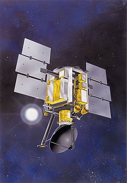
Artist conception of QuikSCAT
|
|
| Mission type | Earth observation |
|---|---|
| Operator | NASA / JPL |
| COSPAR ID | 1999-034A |
| SATCAT no. | 25789 |
| Website | winds |
| Mission duration | 10 years, 4 months |
| Spacecraft properties | |
| Manufacturer | Ball Aerospace |
| Launch mass | 970 kilograms (2,140 lb) |
| Power | 874 watts |
| Start of mission | |
| Launch date | 19 June 1999, 02:15:00 UTC |
| Rocket | Titan II(23)G |
| Launch site | Vandenberg SLC-4W |
| End of mission | |
| Deactivated | Last science data returned: 19 November 2009 |
| Orbital parameters | |
| Reference system | Geocentric |
| Regime | Sun-synchronous |
| Semi-major axis | 7,180.8 kilometers (4,461.9 mi) |
| Eccentricity | 0.0001431 |
| Perigee | 807.9 kilometres (502.0 mi) |
| Apogee | 809.8 kilometres (503.2 mi) |
| Inclination | 98.6175 degrees |
| Period | 100.93 minutes |
| RAAN | 101.8215 degrees |
| Argument of perigee | 71.6425 degrees |
| Mean anomaly | 308.4160 degrees |
| Mean motion | 14.27019630 |
| Repeat interval | ≈4 days (57 orbits) |
| Epoch | 30 September 2013, 12:15:56 UTC |
| Revolution no. | 74382 |
The NASA QuikSCAT (Quick Scatterometer) is an Earth observation satellite carrying the SeaWinds scatterometer. Its primary mission is to measure the surface wind speed and direction over the ice-free global oceans. Observations from QuikSCAT have a wide array of applications, and have contributed to climatological studies, weather forecasting, meteorology, oceanographic research, marine safety, commercial fishing, tracking large icebergs, and studies of land and sea ice, among others. This SeaWinds scatterometer is referred to as the QuikSCAT scatterometer to distinguish it from the nearly identical SeaWinds scatterometer flown on the ADEOS-2 satellite.
QuikSCAT was launched on 19 June 1999 with an initial 3-year mission requirement. QuikSCAT was a "quick recovery" mission replacing the NASA Scatterometer (NSCAT), which failed prematurely in June 1997 after just 9.5 months in operation. QuikSCAT, however, far exceeded these design expectations and continued to operate for over a decade before a bearing failure on its antenna motor ended QuikSCAT's capabilities to determine useful surface wind information on 23 November 2009. The QuikSCAT geophysical data record spans from 19 July 1999 to 21 November 2009.
Throughout its operational lifetime, QuikSCAT measured winds in measurement swaths 1,800 km wide centered on the satellite ground track with no nadir gap, such as occurs with fan-beam scatterometers such as NSCAT. Because of its wide swath and lack of in-swath gaps, QuikSCAT was able to collect at least one vector wind measurement over 93% of the World's Oceans each day. This improved significantly over the 77% coverage provided by NSCAT. Each day, QuikSCAT recorded over 400,000 measurements of wind speed and direction. This is hundreds of times more surface wind measurements than are collected routinely from ships and buoys.
QuikSCAT provided measurements of the wind speed and direction referenced to 10 meters above the sea surface at a spatial resolution of 25 km. Wind information cannot be retrieved within 15–30 km of coastlines or in the presence of sea ice. Precipitation generally degrades the wind measurement accuracy, although useful wind and rain information can still be obtained in mid-latitude and tropical cyclones for monitoring purposes. In addition to measuring surface winds over the ocean, scatterometers such as QuikSCAT can also provide information on the fractional coverage of sea ice, track large icebergs (>5 km in length), differentiate types of ice and snow, and detect the freeze–thaw line in polar regions.
...
Wikipedia
