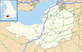
Priddy Nine Barrows and Ashen Hill Barrow Cemeteries

Priddy Nine Barrows Cemetery
|
|
| Coordinates | 51°15′46″N 2°39′45″W / 51.26278°N 2.66250°WCoordinates: 51°15′46″N 2°39′45″W / 51.26278°N 2.66250°W |
|---|---|
| Official name | Group of seven round barrows 380m east of East Water Drove (Part of Priddy Nine Barrows Cemetery) |
| Designated | 9 October 1981 |
| Reference no. | 1010503 |
| Official name | Ashen Hill barrow cemetery: a group of eight round barrows 500m southeast of Harptree Lodge |
| Designated | 20 July 1933 |
| Reference no. | 1010513 |
Priddy Nine Barrows Cemetery and Ashen Hill Barrow Cemetery are a collection of round barrows, dating from the Bronze Age, near Priddy in the English county of Somerset. They are designated as ancient monuments.
The barrows sit on crests of land at either end of a field in an area of the Mendip Hills with several Neolithic remains. They are assumed to be related to the Priddy Circles which lie 750 metres (2,460 ft) to the north. Ashen Hill consists of six bowl barrows and two bell barrows aligned east to west while Priddy Nine Barrows divided into one group of seven round barrows and another pair slightly separated from the others.
Excavations in 1815 uncovered cremation burials and grave goods. A geophysical magnetometry survey suggested that there may have been three further barrows.
The field where the monuments are located is 750 metres (2,460 ft) south of the Priddy Circles, a linear arrangement of four circular earthwork enclosures described as 'probable Neolithic ritual or ceremonial monuments similar to a henge'.
It is approximately 1 kilometre (0.62 mi) east of the village of Priddy itself and 0.5 kilometres (0.31 mi) west of a Forestry Commission plantation. Between the barrows and Stock Hill is the Priddy Mineries, a nature reserve of the Somerset Wildlife Trust, which is itself a is part of the Priddy Pools Site of Special Scientific Interest (SSSI) which was worked for lead for many centuries.
...
Wikipedia

