Praděd
| Praděd | |
|---|---|

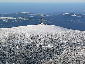
Aerial view of Praděd
|
|
| Highest point | |
| Elevation | 1,491.3 m (4,893 ft) |
| Coordinates | 50°5′0″N 17°14′0″E / 50.08333°N 17.23333°ECoordinates: 50°5′0″N 17°14′0″E / 50.08333°N 17.23333°E |
| Geography | |
| Location | West Silesia, Czech Republic |
| Parent range | Hrubý Jeseník |
Praděd (Czech pronunciation: [ˈpraɟɛt]; German: Altvater; Polish: Pradziad; "Grandfather") (1,491.5 metres) is the highest mountain of Hrubý Jeseník mountains, Moravia, Czech Silesia and Upper Silesia and is fifth highest mountain of Czech Republic. The average annual temperature is about 1°C. A television transmitter is situated on the top, 162 m high. The upper platform is used as a watchtower. The mountain is also a popular area for skiing.
First building on the mountain was a stone watchtower, 32 m high. It was built between 1903 and 1912 by the Sudeten German tourist association. After 1945, the tourist association no longer existed because all Germans were expelled. Due to its unmaintained condition in communist Czechoslovakia, with water freezing in cracks breaking it up, the watchtower collapsed May 2, 1959 shortly before it was supposed to get fixed.
The Petrovy kameny (Peter’s stones) is a gneiss stone formation in the Hrubý Jeseník mountain range of the Czech Republic, near the peak. In the Middle Ages, people feared the place, believing witches lived there. The area is home to many rare plants, so it is not open to the public.
...
Wikipedia

