Prachuap Khiri Khan province
|
Prachuap Khiri Khan ประจวบคีรีขันธ์ |
||
|---|---|---|
| Province | ||

Laem Sala Beach
|
||
|
||
| Nickname(s): Prachuap | ||
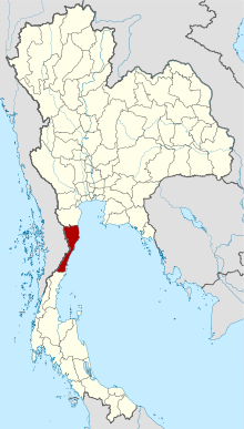
 Map of Thailand highlighting Prachuap Khiri Khan Province |
||
| Country | Thailand | |
| Capital | Prachuap Khiri Khan | |
| Government | ||
| • Governor | Thawi Naritsirikun (since October 2015) | |
| Area | ||
| • Total | 6,367.6 km2 (2,458.5 sq mi) | |
| Area rank | Ranked 33rd | |
| Population (2014) | ||
| • Total | 525,107 | |
| • Rank | Ranked 51st | |
| • Density | 82/km2 (210/sq mi) | |
| • Density rank | Ranked 58th | |
| Time zone | ICT (UTC+7) | |
| ISO 3166 code | TH-77 | |
Prachuap Khiri Khan (Thai: ประจวบคีรีขันธ์, pronounced [prā.t͡ɕùa̯p.kʰīː.rīː.kʰǎn]) is one of the western provinces (changwat) of Thailand. It is in the northern part of the Malay Peninsula, some 240 km (150 mi) south of Bangkok. Neighboring provinces are Phetchaburi to the north and Chumphon to the south. To the west it borders Tanintharyi Region of Myanmar.
Prachuap Khiri Khan covers an area of 6,367.62 square kilometres (2,458.55 sq mi). The province is on the Kra Isthmus, the narrow land bridge connecting the Malay Peninsula with mainland Asia. The province contains the narrowest part of Thailand. At its narrowest, it is just 13 km (8.1 mi) from the coast of the Gulf of Thailand to the border with Myanmar in the Tenasserim Hills. Geographically, Prachuap Khiri Khan is a moderate plain with elevations varying from sea level to 1,200 m (3,900 ft). The maximum elevations are found in the northeastern and central west regions, which make up approximately 30 percent of the province.
.
The long coast of the Gulf of Thailand has many sandy beaches. One of the best known, Hua Hin, has been a popular resort since King Prajadhipok (Rama VII) built a summer palace there. From the coast the land quickly rises into the Tenasserim Hills, the mountain chain that forms the border with Myanmar. Due to its narrow watershed, the rivers in the province are all small. The only one of significance is the Pranburi River in the north. Among the smaller rivers is the Khlong Kui.
Khao Sam Roi Yot National Park was established in 1966 to protect Thailand's largest freshwater marshes. The park contains some mangrove forests and mudflats. Most of the marshes were converted into shrimp farms, despite being in a national park.
...
Wikipedia

