Poverty Point
| Poverty Point National Monument | |
|---|---|
|
IUCN category V (protected landscape/seascape)
|
|

A map of the Poverty Point site
|
|
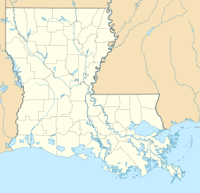
| Location | West Carroll Parish, Louisiana, U.S. |
| Nearest city | Epps, Louisiana |
| Coordinates | 32°38′12″N 91°24′41″W / 32.63667°N 91.41139°WCoordinates: 32°38′12″N 91°24′41″W / 32.63667°N 91.41139°W |
| Area | 910.85 acres (368.61 ha) |
| Authorized | October 31, 1988 |
| Governing body |
State of Louisiana National Park Service |
| Website | Poverty Point National Monument |
| Official name | Monumental Earthworks of Poverty Point |
| Type | Cultural |
| Criteria | iii |
| Designated | 2014 (38th session) |
| Reference no. | 1435 |
| State Party | United States |
| Region | Europe and North America |
Poverty Point (French: Pointe de Pauvreté) (16 WC 5) is a prehistoric earthworks of the Poverty Point culture, now a U.S. National Monument and World Heritage Site located in the Southern United States. It is 15.5 miles (24.9 km) from the current Mississippi River, and situated on the edge of Maçon Ridge, near the village of Epps in West Carroll Parish in northeastern Louisiana.
Poverty Point comprises several earthworks and mounds built between 1650 and 700 BC, during the archaic period in North America by a group of Native Americans of the Poverty Point culture. The culture extended 100 miles (160 km) across the Mississippi Delta. The original purposes of Poverty Point have not been determined by archaeologists, although they have proposed various possibilities including that it was: a settlement, a trading center, and/or a ceremonial religious complex.
The 910-acre (1.42 sq mi; 3.68 km2) site, which has been described as "the largest and most complex Late Archaic earthwork occupation and ceremonial site yet found in North America" is a registered National Monument. The monument was brought to the attention of archaeologists in the early 20th century, when it was given the name of Poverty Point after a nearby plantation. Since then, various excavations have taken place at the site. Scholars have advanced various theories regarding the purpose of the mound site, including religious and ceremonial. Other writers have proposed pseudo-archaeological and New Age associations. The complex attracts many tourists as a destination.
...
Wikipedia


