Potter Lake, Wisconsin
| Potter Lake, Wisconsin | |
|---|---|
| CDP | |
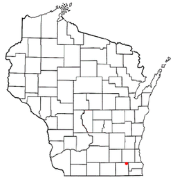
 Location of Potter Lake, Wisconsin |
|
| Coordinates: 42°49′18″N 88°20′56″W / 42.82167°N 88.34889°WCoordinates: 42°49′18″N 88°20′56″W / 42.82167°N 88.34889°W | |
| Country | United States |
| State | Wisconsin |
| County | Walworth |
| Area | |
| • Total | 1.294 sq mi (3.35 km2) |
| • Land | 1.052 sq mi (2.72 km2) |
| • Water | 0.242 sq mi (0.63 km2) |
| Elevation | 846 ft (258 m) |
| Population (2010) | |
| • Total | 1,107 |
| • Density | 860/sq mi (330/km2) |
| Time zone | Central (CST) (UTC-6) |
| • Summer (DST) | CDT (UTC-5) |
| Area code(s) | 262 |
| FIPS code | 55-64700 |
| GNIS feature ID | 1867664 |
Potter Lake is a census-designated place (CDP) in the town of Troy, Walworth County, Wisconsin, United States. The population was 1,107 at the 2010 census.
Potter Lake is located at 42°49′18″N 88°20′56″W / 42.82167°N 88.34889°W (42.821598, -88.348858).
According to the United States Census Bureau, the CDP has a total area of 1.3 square miles (3.4 km²), of which, 1.1 square miles (2.7 km²) of it is land and 0.2 square miles (0.6 km²) of it (18.70%) is water.
As of the census of 2000, there were 1,099 people, 415 households, and 331 families residing in the CDP. The population density was 779.9 people per square mile (300.9/km²). There were 460 housing units at an average density of 326.4/sq mi (126.0/km²). The racial makeup of the CDP was 98.27% White, 0.18% African American, 0.09% Native American, 0.09% Asian, 0.36% from other races, and 1.00% from two or more races. Hispanic or Latino of any race were 0.82% of the population.
...
Wikipedia
