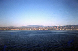
Port of Latakia
| Port of Latakia ميناء اللاذقية |
|
|---|---|

Port of Latakia in 1979
|
|
| Location | |
| Country | Syria |
| Location |
Latakia Latakia Governorate |
| Coordinates | 35°30′48″N 35°46′14″E / 35.51333°N 35.77056°ECoordinates: 35°30′48″N 35°46′14″E / 35.51333°N 35.77056°E |
| Details | |
| Opened | Ancient harbor: 2000 BC Modern harbor: 1951 |
| Operated by | Public Company of the Port of Latakia |
| Owned by | State-owned |
| Type of harbor | Natural |
| Size of harbor | 135 hectares (0.52 sq mi) |
| Land area | 15 hectares (0.058 sq mi) |
| Size | 150 hectares (0.58 sq mi) |
| Wharfs | 32 |
| General Manager | Suleiman Asaad Baloush |
| Cranes | 18 |
| Channel depth | 14.5 metres (48 ft) |
| Warehouse space | 62.8 hectares (0.242 sq mi) |
| Statistics | |
| Vessel arrivals | 1805 |
| Annual cargo tonnage | 8,093,000 |
|
Website http://www.lattakiaport.gov.sy/ |
|
The Port of Latakia (Arabic: ميناء اللاذقية) is the main seaport in Syria. It is located on the Mediterranean Sea in the city of Latakia.
In 2008, the port handled about 8 million tonnes of cargo.
...
Wikipedia
