Ponta do Sinó
| Ponta do Sinó | |
|---|---|

The lighthouse and the headland facing about southwest and the point
|
|
| Location | Southern Sal, Cape Verde near Santa Maria |
| Coordinates | 16°35′06″N 22°55′25″W / 16.5851°N 22.9235°WCoordinates: 16°35′06″N 22°55′25″W / 16.5851°N 22.9235°W |
| Offshore water bodies | Atlantic Ocean |
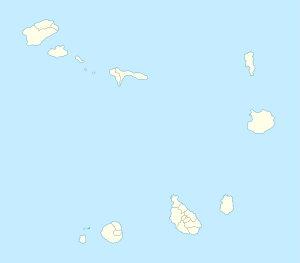
Ponta do Sinó is the southernmost point of the island of Sal in Cape Verde over a kilometer west of Santa Maria and is over 20 km south of the island capital of Espargos. The nearest settlement is Terra Boa, 5 km to the southeast. It has a headland that is over 1.6 km east to west and about a kilometer wide. At that location, it is the point closest to Boa Vista Island at Ponta do Sol being 39.3 km apart.
It is the area separating the beaches of Ponta Preta and Santa Maria and its wide harbour and has been designated a protected area as a nature reserve, it may cover nearby Ponta Preta but includes the waters surrounding the headland.
It is also a subdivision that is an uninhabited section of the city which covers the headland and is a touristic area dominated by hotels and villas. The first resort was Morabeza constructed next to the headland in 1967, more of the resorts were constructed in 1999 and were finished in 2001 or 2002 and in 2004 near the point, more of them were constructed in 2007 and 2008 in the headland's limits and recently in mid-2015 surrounding the lighthouse towards the east. Nearby resorts are Funaná and Vila do Farol and its adjacent theater located in the headland, other resorts are in the area including Belo Horizonte, Crioulo and Garupa. Nonetheless, the oldest and the most famous landmark in the area is its lighthouse of the same name built in 1892 and is now located close to the sea with a newer one. Almost all these are connected by Caminho de Ponta do Sinó, a small road linking the town.
West of the lighthouse on 30 August 2015, a then unnamed species of bushes of the Arthrocnemum genus was described with its type location being west of the lighthouse at 16°59'02.46" N, 22°92'42.72" W and are founded in sandy depressions in the area, they are also founded in other parts of the area and in two other islands to the south, they were named in 2016 as Arthrocnemum franzii.
Tourism is the main industry today in the headland as well as the city.
Surrounding the headland have its waters shallow but has a small size as 1 km south has the waters 100 meters deep, 4 km south has a depth of 1,000 meters and forms part of the Cape Verde Rise and is the depth range at a third of the way to the island in one part, 17 km south has water at a depth of 2,000 meters and over.
...
Wikipedia

