Polillo, Quezon
| Polillo | ||
|---|---|---|
| Municipality | ||

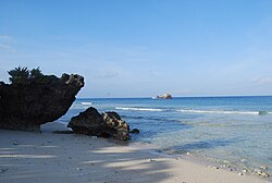
Beach on Balesin Island
|
||
|
||
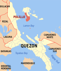
 Map of Quezon showing the location of Polillo |
||
| Location within the Philippines | ||
| Coordinates: 14°43′N 121°57′E / 14.717°N 121.950°ECoordinates: 14°43′N 121°57′E / 14.717°N 121.950°E | ||
| Country | Philippines | |
| Region | CALABARZON (Region IV-A) | |
| Province | Quezon | |
| District | 1st district of Quezon | |
| Founded | March 18, 1587 | |
| Barangays | 24 | |
| Government | ||
| • Mayor | Cristina E. Bosque (NUP) | |
| Area | ||
| • Total | 253.00 km2 (97.68 sq mi) | |
| Population (2015) | ||
| • Total | 30,582 | |
| • Density | 120/km2 (310/sq mi) | |
| Time zone | PST (UTC+8) | |
| ZIP code | 4339 | |
| Dialing code | 42 | |
| Income class | 3rd class; partially urban | |
| Website | www |
|
Polillo is a third class municipality in the province of Quezon, Philippines. It is located on the southern part of the eponymous Polillo Island in the Philippine Sea and its jurisdiction also includes Balesin Island in Lamon Bay (14°25′30″N 122°02′15″E / 14.42500°N 122.03750°E). According to the 2015 census, it has a population of 30,582 people.
Polillo is located about 29 kilometres (18 mi) off the eastern coast of Luzon. It is bounded by municipality of Panukulan in the north, and the municipality of Burdeos in the east. Lamon Bay bounds it at the south, east and west. It is 24 kilometres (15 mi) west of the municipality of Infanta and 27 kilometres (17 mi) northern west of the municipality of Real. It can be reached by motorboats more or less three hours via Real-Polillo in the Ungos Port and a little bit shorter via, Infanta-Polillo through Dinahican Fish Port.
Polillo is politically subdivided into 20 barangays.
Trade relations between the natives of the Polillo Islands and Chinese merchants existed long before the Spanish conquerors came to the archipelago. Trade was a conglomeration of Malay-Hindu-Chinese-Tagalog.
...
Wikipedia


