Pointe-Noire Airport
|
Agostinho Neto International Airport Pointe Noire Airport |
|||||||||||
|---|---|---|---|---|---|---|---|---|---|---|---|
| Summary | |||||||||||
| Serves | Pointe-Noire, Republic of the Congo | ||||||||||
| Hub for | |||||||||||
| Elevation AMSL | 55 ft / 17 m | ||||||||||
| Coordinates | 04°48′48″S 11°53′09″E / 4.81333°S 11.88583°E | ||||||||||
| Website | pointenoireairport |
||||||||||
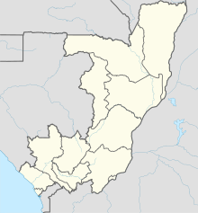
| Map | |||||||||||
| Location of Airport in Republic of the Congo | |||||||||||
| Runways | |||||||||||
|
|||||||||||
Antonio Agostinho Neto International Airport (IATA: PNR, ICAO: FCPP) is an airport serving Pointe-Noire, Republic of the Congo. It is one of two international airports in the country, the other being Brazzaville Maya–Maya Airport.
The airport was inaugurated in 1934; a new passenger terminal opened in 2006.
...
Wikipedia

