Point Calimere Wildlife and Bird Sanctuary
| Point Calimere Wildlife and Bird Sanctuary | |
|---|---|
|
IUCN category IV (habitat/species management area)
|
|
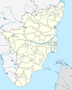
| Location in India | |
| Location | Tamil Nadu, India |
| Coordinates | 10°19′N 79°52′E / 10.31°N 79.86°ECoordinates: 10°19′N 79°52′E / 10.31°N 79.86°E |
| Area | 21.47 km2 (8.29 sq mi) |
| Established | 1967 |
| Governing body | Tamil Nadu Forest Department |
| http://www.forests.tn.nic.in/WildBiodiversity/ws_pcws.html | |
Point Calimere Wildlife and Bird Sanctuary (PCWBS) is a 21.47-square-kilometre (8.29 sq mi) protected area in Tamil Nadu, South India along the Palk Strait where it meets the Bay of Bengal at Point Calimere at the southeastern tip of Nagapattinam District. The sanctuary was created in 1967 for conservation of the near threatened blackbuck antelope, an endemic mammal species of India. It is famous for large congregations of waterbirds, especially greater flamingos. International name: Point Calimere Wildlife Sanctuary, IBA Code: IN275, Criteria: A1, A4i, A4iii. The 7-square-kilometre (2.7 sq mi) core area of this sanctuary has been proposed as a National Park
Before 1968 AD Ptolemy referred to Point Calimere as Calligicum prom.. Use of the term Point Calimere appears to date back at least to between the early 16th century, when Portuguese traders started commercial contacts with nearby Nagapattinam town, and 1554 when they established a commercial center there. In the Portuguese language calido means warm and mar means sea.
In the 8th century a brick and mortar lighthouse at Calimere Point was said to have been built during the regime of Raja Raja Chola I. In 1890 the British erected a 13-metre (43 ft) lighthouse at Point Calimere which is still in use near the remains of the old Chola lighthouse.
Before 1892 the forests around Point Calimere were administered by the Revenue Department and Temple trustees who allowed local people to collect firewood, fish and minor forest products. Forest management practices in the area began in 1892 with creation of the 14.75-square-kilometre (5.70 sq mi) Kodaikadu Reserved Forest. A small area near the Sanyasin Muniaswar Temple was used by the British as a hunting ground and later cleared and replanted with casuarina and eucalyptus for firewood production. Some of these old trees remain. Palmyrah trees were planted to mark the village forests from the Reserved Forest near Munniappan Lake. There is a shrine to the deities Shevrayan and Soni located deep in the forests of the northern part of the sanctuary. A small village near Shevrayan Kovil shrine was relocated outside the sanctuary after the creation of Kodaikarai Reserve Forest. A few uncommon Indian tulip and neem trees from this old settlement still remain.
...
Wikipedia

