Pleasanton Ridge Regional Park
| Pleasanton Ridge Regional Park | |
|---|---|

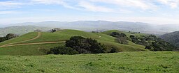
View looking south along the ridge from one of the peaks
|
|
| Location | Pleasanton, California |
| Coordinates | 37°36′55″N 121°53′04″W / 37.6154094°N 121.8845595°WCoordinates: 37°36′55″N 121°53′04″W / 37.6154094°N 121.8845595°W |
| Area | 5,271-acre (21.33 km2) |
| Operated by | East Bay Regional Park District |
Pleasanton Ridge Regional Park is a 5,271-acre (21.33 km2) park in the East Bay Regional Park District overlooking Pleasanton, California and the Livermore Valley to the east. The park is scheduled to grow by almost 1,500 acres (6.1 km2) with the acquisition of the Tyler Ranch.
Adjacent to the park is the Augustin Bernal Park.
...
Wikipedia


