Placencia
| Placencia | |
|---|---|
| Village | |

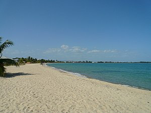
Maya Beach, Placencia
|
|
| Coordinates: 16°30′50″N 88°22′0″W / 16.51389°N 88.36667°W | |
| Country |
|
| District | Stann Creek |
| Constituency | Stann Creek West |
| Population (2010) | |
| • Total | 750 (est) |
| Time zone | Central No DST (UTC-6) |
| Climate | Am |
Placencia is a small town located in the Stann Creek District of Belize.
In the 17th century, Placencia was settled by the English Puritans, originally from Nova Scotia and latterly from the island of Providencia. This settlement died out during the Central American wars of independence in the 1820s.
The Placencia Peninsula was resettled in the late 1800s by several families. Placencia prospered and soon became a village, earning its livelihood from the sea.
The Spaniards that traveled the southern coast of Belize gave Placencia its name. At that time Placencia was called Placentia, with the point being called Punta Placentia, or Pleasant Point.
On October 8, 2001, Hurricane Iris hit southern Belize with 145 mph winds causing major damage to nearly 95% of buildings in Placencia. Many developers took advantage of plummeted real estate value and an increased development of the peninsula and Placencia proper is consistently on the rise, as well as property value.
In the late 20th century it became a significant tourism destination, and is now referred to as Placencia Village, or simply Placencia.
The eastern side of the Peninsula is a long expanse of white sand beach and heavy mangrove in some areas; the western side is bounded by a long narrow north-south trending bay of the Caribbean Sea. A significant settlement on the peninsula is the Garifuna village of Seine Bight. Placencia is served by Placencia Airport.
The village is home to 458 permanent residents according to the 2000 census. The 2009 population estimate for Placencia Village is 750. The population in 2016 is closer to 1,500. This does not include many expats and long term visitors who make up a great deal of the population.
Placencia Bar Beachfront
The narrowest street in the world, Placencia
Fisheye view of Cabanas
The area was established as Maya Beach and registered as a subdivision in the 1960s. Slow but steady growth due to tourism, immigration to the area and Belizeans moving to the area for jobs has resulted in a population estimated by some to be as high as 200.
Throughout Maya Beach the peninsula is quite narrow, approximately 300–600 feet across from the sea to lagoon. Most properties have beach, lagoon or canal frontage.
...
Wikipedia

