Piney Pinecreek Border Airport
| Piney Pinecreek Border Airport Pinecreek/Piney Pinecreek Border Aerodrome |
|||||||||||
|---|---|---|---|---|---|---|---|---|---|---|---|
| Summary | |||||||||||
| Airport type | Public | ||||||||||
| Owner | Minnesota DOT | ||||||||||
| Operator | Piney/Pinecreek Border Airport Commission | ||||||||||
| Serves | Piney, Manitoba Pinecreek, Minnesota |
||||||||||
| Location | Canada–United States border | ||||||||||
| Time zone | CST (UTC−06:00) | ||||||||||
| • Summer (DST) | CDT (UTC−05:00) | ||||||||||
| Elevation AMSL | 1,082 ft / 330 m | ||||||||||
| Coordinates | 48°59′56″N 095°58′56″W / 48.99889°N 95.98222°WCoordinates: 48°59′56″N 095°58′56″W / 48.99889°N 95.98222°W | ||||||||||
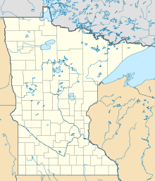
| Map | |||||||||||
| Runways | |||||||||||
|
|||||||||||
| Statistics (2008) | |||||||||||
|
|||||||||||
|
Sources: Federal Aviation Administration and Canada Flight Supplement
|
|||||||||||
Piney Pinecreek Border Airport (ICAO: K48Y, FAA LID: 48Y, TC LID: K48Y) is a public use airport located 2 nautical miles (3.7 km; 2.3 mi) northwest of the central business district of Pinecreek, in Dieter Township, Roseau County, Minnesota, United States, on the Canada–US border. It is owned by the Minnesota Department of Transportation. It is shared by the rural communities of Piney, Manitoba and Pinecreek, Minnesota.
Also known as Pinecreek/Piney Pinecreek Border Aerodrome, it is one of six airports that cross the Canada–US border, the only one with a paved runway, and the easternmost. The other airports, east to west, are International Peace Garden Airport, Coronach/Scobey Border Station Airport, Coutts/Ross International Airport, Whetstone International Airport (Del Bonita/Whetstone International Airport), and Avey Field State Airport.
The airport, located at 48°59′56″N 095°58′56″W / 48.99889°N 95.98222°W, was originally located entirely within the United States. Needing to extend the runway, the owners found it could not be extended south due to a nearby road, but the land to the immediate north was unused. After arrangements were made with Canadian and Manitoba authorities, the runway was extended across the 49th parallel.
...
Wikipedia


