Pilatus (mountain)
| Pilatus | |
|---|---|

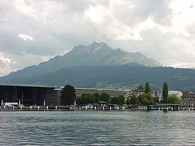
The iconic Pilatus above Lucerne
|
|
| Highest point | |
| Peak | Tomlishorn |
| Elevation | 2,128 m (6,982 ft) |
| Prominence | 585 m (1,919 ft) |
| Isolation | 16.7 km (10.4 mi) |
| Parent peak | Brienzer Rothorn |
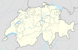
| Coordinates | 46°58′26″N 8°14′28″E / 46.97389°N 8.24111°ECoordinates: 46°58′26″N 8°14′28″E / 46.97389°N 8.24111°E |
| Geography | |
| Country | Switzerland |
| Cantons | Nidwalden and Obwalden |
| Parent range | Emmental Alps |
| Topo map | Swiss Federal Office of Topography swisstopo |
| Climbing | |
| First ascent | 14th century |
| Easiest route | Pilatus Railway (world's steepest cogwheel railway) |
Pilatus (also often referred to Mount Pilatus) is a mountain massif overlooking Lucerne in Central Switzerland. It is composed of several peaks, of which the highest (2,128 m (6,982 ft)) is named Tomlishorn and is located about 1.3 km (0.81 mi) to the southeast of the top cable car and cog railway station. The two peaks right next to the stations are called Esel (Donkey, 2,118 m (6,949 ft)), which lies just east over the railway station, the one on the west side is called Oberhaupt (Head-Leader, 2,105 m (6,906 ft)). Jurisdiction over the massif is divided between the cantons of Obwalden (OW), Nidwalden (NW), and Lucerne (LU). The main peaks are right on the border between Obwalden and Nidwalden.
The top can be reached with the Pilatus Railway, the world's steepest cogwheel railway, from Alpnachstad, operating from May to November (depending on snow conditions), and the whole year with the aerial panorama gondolas and aerial cableways from Kriens. Both peaks next to the top stations, Esel and Oberhaupt, can easily be reached also by mass tourism.
The highest peak however, Tomlishorn, and the other peaks, such as Widderfeld (2,128 m (6,982 ft)) even further west than the Tomlishorn on the border between LU and OW, Matthorn (2,040 m (6,690 ft)) to the south, the Klimsenhorn (1,906 m (6,253 ft)) to the north (UW), and Rosegg (1,974 m (6,476 ft)) and Windegg (1,673 m (5,489 ft)) to the east, both on the border of UW and OW, should only be approached with appropriate Alpine hiking equipement.
The whole mountain range streches at least from the Lopper just opposite from Stansstad to the east as far as at least to the Mittaggüpfi (1,917 m (6,289 ft)) and the Risetestock (1,759 m (5,771 ft)) to the west on the border between LU and OW.
...
Wikipedia

