Phnom Kulen National Park
| Phnom Kulen National Park | |
|---|---|
|
IUCN category II (national park)
|
|

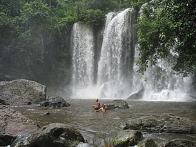
Waterfall in Phnom Kulen National Park
|
|
| Location | Cambodia |
| Nearest city | Siem Reap |
| Coordinates | 13°36′22″N 104°05′45″E / 13.6062°N 104.0957°ECoordinates: 13°36′22″N 104°05′45″E / 13.6062°N 104.0957°E |
| Area | 375 km2 (145 sq mi) |
| Established | 1993 |
Phnom Kulen National Park is a National park in Cambodia. It is located in the Phnom Kulen (Khmer: ភ្នំគូលេន) mountain massif in Siem Reap Province. During Angkorian era the relief was known as Mahendraparvata (the mountain of Great Indra) and was the place where Jayavarman II had himself declared chakravartin (King of Kings), an act which is considered the foundation of Khmer Empire.
Phnom Kulen National Park is located in Svay Leu District about 48 km from the provincial town of Siem Reap and about 25 km from Prasat Banteay Srey via Charles De Gaulle Road. At Phnom Kulen there are several attractive places, such as:
Chup Preah (Khmer: ជប់ព្រះ) is the plain spot where having cool water flows and is located at the mountain’s valley. Next to it, there is a rare big tree of Cham Pa having 0.7 meter diameter and 15-meter height. At Chup Preah, there is a big Buddhist statue and many other small statues made during the 16th century.
The Kbal Spean archaeological site, also known as "Valley of a thousand Lingas" (Khmer: លឹង្គ១០០០), is located on the mountain, along the Kbal Spean River, which is tributary of Siem Reap River. The site has many figures of Yoni and Linga as well as other figures carved into the rocks of the riverbed and banks which may become fully exposed in the dry season when the river dries up. The river is shallow and small waterfalls form at the site in the wet season. The site is accessible by trekking uphill through a 1.5 km jungle track from the parking site.
...
Wikipedia

