Phelps Collins Air National Guard Base
| Alpena Combat Readiness Training Center | |
|---|---|
| Part of Michigan Air National Guard (MI ANG) | |

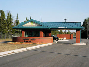
Alpena Combat Readiness Training Center Main Gate
|
|
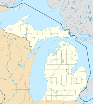
| Coordinates | 45°05′10″N 083°34′25″W / 45.08611°N 83.57361°WCoordinates: 45°05′10″N 083°34′25″W / 45.08611°N 83.57361°W |
| Type | Training Center |
| Site information | |
| Owner |
|
| Controlled by |
|
| Site history | |
| Built | 1940 |
| In use | 1941–1945; 1954 – present |
| Garrison information | |
| Garrison |
|
Alpena Combat Readiness Training Center is a Michigan Air National Guard training facility. It is located 7.1 miles (11.4 km) west-northwest of Alpena, Michigan.
The Alpena CRTC is a year-round training facility. It provides premier support, facilities, instruction and airspace to Department of Defense, Department of Homeland Security, Coalition and emergency responders to meet the mission requirements of combatant commanders and civil authorities.
It is one of four Combat Readiness Training Centers in the United States. (The others are at Volk Field in Wisconsin; Gulfport, Mississippi; and Savannah, Georgia.) The Alpena CRTC boasts the largest airspace east of the Mississippi River, has 147,000 acres available for ground maneuver units, and trains over 20,000 joint and coalition personnel annually.
The Alpena CRTC is the second organization in the Air National Guard to be certified as a Joint National Training Center. The base has three JTE's, offers JTAC Training, and operates a JTAC 4m dome simulator.
Alpena Combat Readiness Training Center (CRTC), formerly named Phelps Collins Field and the Phelps Collins Air National Guard Base, has a long interesting history beginning in the early 20th century. Before that date, the area had a reputation for yielding blueberries in abundance to local Indians and early settlers in the area. In the early 20th century, the area was known as the "Seven Mile Plains" named because the flat open area stretching from the Seven Mile Dam to M-32.
During the early part of the 20th century, flying machines began to appear in the sky over most of the country including the Alpena area. It didn't take long for the early aeronautical risk takers to realize the flat open area was just what they needed to land and take off with their aircraft known as Jennies. The landing area was a bit rough going, but so was the practice of flying in general during those early years.
Around the same time, local developers and land owners realized the potential of the flat area and foresaw the need for a landing strip as a result of the onset of air travel. Thus the idea of an airport was born. Harry Fletcher and his brother Philip (Nephews of Alan M. Fletcher, founder of Fletcher Paper Co.) began negotiations along with Robert Scott (then president of Scott Engineering) and James McQuarrie, who later sat on the County Board's Airport Committee. These individuals were fundamental in developing the plan and getting the state on board.
...
Wikipedia


