Pha Daeng National Park
| Pha Daeng National Park | |
|---|---|
| อุทยานแห่งชาติผาแดง | |
|
IUCN category II (national park)
|
|
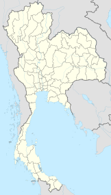
| Location | Chiang Dao District, Chiang Mai Province, Thailand |
| Coordinates | 19°37′43.025″N 98°57′21.772″E / 19.62861806°N 98.95604778°ECoordinates: 19°37′43.025″N 98°57′21.772″E / 19.62861806°N 98.95604778°E |
| Area | 1,123 km2 |
| Established | 2 Nov 2000 |
Pha Daeng National Park (Thai: อุทยานแห่งชาติผาแดง), formerly known as Chiang Dao National Park, is a national park in Chiang Mai Province, Thailand. Established on 2 November 2000, the park covers 1,123 km2 of the Pha Daeng mountain areas of the Daen Lao Range near the border with Burma, just north of Chiang Dao Wildlife Sanctuary. The tallest summit is 1,794 m high Doi Puk Phakka.
...
Wikipedia

