Petersburg Census Area
| Petersburg Borough, Alaska | |
|---|---|
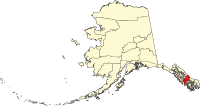
 Location in the U.S. state of Alaska |
|
 Alaska's location in the U.S. |
|
| Incorporated | January 3, 2013 |
| Named for | Petersburg |
| Seat | Petersburg |
| Largest city | Petersburg |
| Area | |
| • Total | 3,829 sq mi (9,917 km2) |
| Population (est.) | |
| • (2015) | 3,177 |
| • Density | 0.8/sq mi (0/km²) |
| Congressional district | At-large |
| Time zone | Alaska: UTC-9/-8 |
| Website | ci |
Petersburg Borough is a borough in the U.S. state of Alaska. According to Census Bureau estimates, the population was 3,177 in 2015. The borough seat is Petersburg.
When the borough incorporated in 2013, it took area from the Hoonah–Angoon Census Area and the former Petersburg Census Area. The remaining portion of Petersburg Census Area (including Kake) was added to Prince of Wales–Hyder Census Area. Petersburg Census Area was created in 2008 from the remaining portion of Wrangell–Petersburg Census Area upon the incorporation of the City and Borough of Wrangell. A map of the old Petersburg Census Area boundaries can be seen here:
Coordinates: 56°37′00″N 133°21′00″W / 56.6167°N 133.3500°W
...
Wikipedia
