Perkiomen Township, Montgomery County, Pennsylvania
| Perkiomen Township | |
| Township | |
|
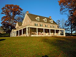
Pennypacker Mills, built 1720
|
|
| Country | United States |
|---|---|
| State | Pennsylvania |
| County | Montgomery |
| Elevation | 148 ft (45.1 m) |
| Coordinates | 40°15′06″N 75°27′29″W / 40.25167°N 75.45806°WCoordinates: 40°15′06″N 75°27′29″W / 40.25167°N 75.45806°W |
| Area | 4.9 sq mi (12.7 km2) |
| - land | 4.8 sq mi (12 km2) |
| - water | 0.1 sq mi (0 km2), 2.04% |
| Population | 9,139 (2010) |
| Density | 1,467.5/sq mi (566.6/km2) |
| Timezone | EST (UTC-5) |
| - summer (DST) | EDT (UTC-4) |
| Area code | 610 |
|
Location of Perkiomen Township in Montgomery County
|
|
|
Location of Pennsylvania in the United States
|
|
| Website: http://www.perkiomentownship.org | |
Perkiomen Township is a township in Montgomery County, Pennsylvania, in the United States. As of the 2010 census, the township population was 9,139, which represents a 28.8% increase from the 2000 total of 7,093 residents. Governmentally, it is a township of the second class, governed by a board of supervisors. It is part of the Perkiomen Valley School District. Perkiomen Township includes an abundance of history that goes as far back as to the first tribes who inhabited the area. This township started with the inhabitants of the Lenni-Lenape Tribe and progressed in many ways into what it is today.
The Perkiomen Valley was first inhabited by the Lenni-Lenape Tribe and was declared The Commonwealth of Pennsylvania on March 4, 1681 by King Charles II of England. The Perkiomen Valley provided the colonists and the Native Americans a rich place to grow crops and livestock, which would later feed the troops during the Revolutionary War. George Washington’s troops rested in the Perkiomen Valley in a place called Valley Forge on their way to defeat the British and gain their autonomy over the thirteen colonies. In 1720, the first copper mine in Pennsylvania was located near Schwenksville. One of the famous men that lived in the Perkiomen Valley was John James Audubon, a French-American ornithologist noted for his paintings and drawings of birds. In 1784, Montgomery County was formed with land that was previously owned by the city of Philadelphia. Nearly a century later in 1879 Limerick Township was created and in 1886 the Skippack and Perkiomen Townships split into Skippack Township and Perkiomen Township. The Perkiomen Township later split into two different townships called Lower Perkiomen Township and Upper Perkiomen Township. Collegeville and Trappe are two towns in Montgomery County that were purchased by Ursinus College in 1869 and was later included in Upper Providence Township in 1896. In 1903, the Schwenksville Borough was incorporated into the Perkiomen Township. In the latest census that was taken in 1990, nearly 59,000 people lived in the Perkiomen Valley. Limerick Township contains the Nuclear Power Plant that produces electricity for the Perkiomen Valley and is owned by a company called PECO. Many businesses that are looking at expanding to the suburbs of Philadelphia look towards the Perkiomen Valley as it is one of the major areas that are rapidly developing into a powerhouse of the suburbs of Philadelphia. They are also moving to the Perkiomen Valley because the businesses are able to escape all of the problems that having a business in Philadelphia creates and they are able to attract more skilled workers to their companies allowing them to grow.
...
Wikipedia


