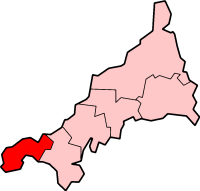
Penwith Peninsula
| Penwith District | |
|---|---|
 |
|
| Population | |
| • 1973 | 51,690 |
| • 2001 | 62,994 |
| History | |
| • Origin |
|
| • Created | 1 April 1974 |
| • Abolished | 1 April 2009 |
| • Succeeded by | Cornwall unitary authority |
| Status | District |
| ONS code | 15UF |
| Government | District council |
| • HQ | Penzance |
| • Motto | Kensa ha Dewetha |
|
|
|
| Subdivisions | |
| • Type | Civil parishes |
 |
|
Penwith (/ˌpɛnˈwɪθ/; Cornish: Pennwydh) is an area of Cornwall, England, United Kingdom, located on the peninsula of the same name. It is also the name of a former local government district, whose council was based in Penzance. The area is named after one of the ancient administrative hundreds of Cornwall which derives from two Cornish words, penn meaning 'headland' and wydh meaning 'at the end'.
Natural England have designated the peninsula as national character area 156 and named it West Penwith. It is also known as the Land's End Peninsula.
The Penwith peninsula sits predominantly on granite bedrock that has led to the formation of a rugged coastline with many fine beaches. The contact between the granite and the adjoining sedimentary rock (mostly shales) is most clearly seen forming the cliffs at Land's End, the most westerly point in the district and this geology has resulted in the mining that has made Cornwall famous. Tin and copper have been mined in the area since pre-Roman times and the landscape is dotted with ruined mine buildings. Inland, the peninsula is primarily granite with a thin top soil. This combined with Cornwall's exposed position and the prevailing weather systems from the Atlantic Ocean means that, with the exception of the high moor areas, much of the area is a semi-bare plateau standing around 130 m above sea level. This is most evident on the north coast between St Just and Zennor where the remains of the ancient seabed of the Pliocene era are visible. Its highest point is Watch Croft (252 m).
...
Wikipedia
