Pedra Branca State Park
| Pedra Branca State Park | |
|---|---|
| Parque Estadual da Pedra Branca | |
|
IUCN category II (national park)
|
|

Burned area in the park (hill in background) in 2014
|
|
| Nearest city | Rio de Janeiro, RJ |
| Coordinates | 22°56′26″S 43°28′50″W / 22.940556°S 43.480556°WCoordinates: 22°56′26″S 43°28′50″W / 22.940556°S 43.480556°W |
| Area | 12,394 ha (47.85 sq mi) |
| Designation | State park |
| Created | 28 June 1974 |
| Administrator | Fundação Instituto Estadual de Florestas (IEF) |
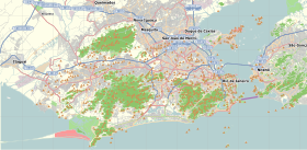
The Pedra Branca State Park (Portuguese: Parque Estadual da Pedra Branca) is a state park in the state of Rio de Janeiro, Brazil. It is one of the largest urban nature parks in the world. It protects an area of Atlantic Forest in the west of the city of Rio de Janeiro that includes the highest point in the city, the Pico da Pedra Branca.
The Pedra Branca State Park is in the west of the city of Rio de Janeiro, and has an area of 12,394 hectares (30,630 acres). It is one of the largest urban nature parks in the world. The park contains the Pico da Pedra Branca, the highest point of the city at 1,024 metres (3,360 ft). It is surrounded by the neighborhoods of Guaratiba, Bangu, Realengo, Jacarepaguá, Barra da Tijuca, Recreio dos Bandeirantes, Grumari and Campo Grande. The park contains the chapel of São Gonçalo do Amarante, built in 1625, and the church of Nossa Senhora de Monserrat, built in 1776.
The park provides water to the Pau da Fome, Camorim, Taxas and Engenho Novo dams. The aqueduct that cuts through the park takes water from the Guandu River to Rio's south zone. The park occupies about 10% of the city, and protects more than half of the city's Atlantic Forest.
European occupation of the Pedra Branca range began late in the 16th century, when Salvador Correia de Sá donated lands in the area to his sons in 1594. At the end of the 17th century some of the land was donated to Benedictine monks, who developed farms and cattle fields. By the end of the 19th century there were extensive coffee plantations, and a movement developed against the resulting deforestation that resulted in some efforts at reforestation. In the early 20th century the old coffee plantations were divided into smaller banana plantations.
...
Wikipedia


