Pedasí District
| Pedasí District | |
|---|---|
| District | |

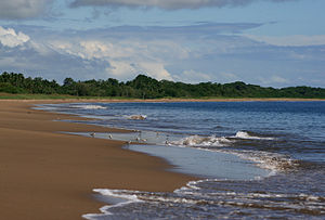
Playa El Arenal, Pedasí, Los Santos
|
|
 |
|
| Location of the district capital in Panama | |
| Coordinates: 7°33′N 80°1′W / 7.550°N 80.017°W | |
| Country |
|
| Province | Los Santos Province |
| Capital | Pedasí |
| Area | |
| • Total | 146.1 sq mi (378.3 km2) |
| Population (2004) | |
| • Total | 3,864 |
| Time zone | ETZ (UTC-5) |
Pedasí (Spanish pronunciation: [peðaˈsi]) is one of five districts of the Los Santos Province, Panama.
Human settlement in the Azuero peninsula where Pedasí is located dates back anywhere from 11,000 years to 4500 years ago based on pre-Columbian artifacts and other archaeological evidence recovered from various sites on the peninsula. Spanish colonizers arrived in the 16th century, largely wiping out or displacing existing indigenous populations.
The district of Pedasí was created in 1840, when Panama was still tenuously united with Colombia (see the History of Panama for more background). At the time, it was a division of the County of Los Santos (today the province of Los Santos), in the Province of Panama (which covered all of present-day Panama, except for the provinces of Veraguas and Bocas del Toro). The population of Pedasí in 1845 was 701 inhabitants.
Since then, the land of the Pedasí district has been used extensively for cattle farming; the cultivation of sorghum, corn, cantaloupe, rice and watermelon; and the coastal villages support a small fishing industry.
The Pedasí district covers an area of 378.3 square kilometers. It was once home to one of Panama’s few swaths of dry tropical forest; however, the area underwent heavy deforestation to make room for cattle pastures during the Spanish colonial era, leaving many of the hills and lowlands denuded. Some 70 hectares of dry tropical forest remain intact in the grounds surrounding the Achotines Laboratory in Pedasí, with another 50 hectares undergoing restoration.
The district of Pedasí is divided into five townships:
...
Wikipedia

