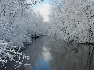
Paw Paw River
| Paw Paw River | |
| river | |
|
The Paw Paw River after a snowfall in Van Buren County, Michigan
|
|
| Country | United States |
|---|---|
| State | Michigan |
| Region | Van Buren County |
| Tributaries | |
| - left | South Branch Paw Paw River, Carter Creek (Paw Paw River), Brush Creek (Paw Paw River), Hog Creek, Pine Creek (Paw Paw River), Mill Creek (Paw Paw River), Ryno Drain, Blue Creek (Paw Paw River), Sand Creek (Paw Paw River) |
| - right | North Branch Paw Paw River, Butterfield Drain, Mud Lake Drain, Paw Paw Lake, Granger Drain |
| Source confluence | Confluence of the North and South Branches Paw Paw River |
| - location | North of Paw Paw, Michigan |
| - elevation | 686 ft (209 m) |
| - coordinates | 42°15′52″N 085°55′35″W / 42.26444°N 85.92639°W |
| Mouth | Benton Harbor, Michigan |
| - elevation | 581 ft (177 m) |
| - coordinates | 42°06′45″N 086°28′15″W / 42.11250°N 86.47083°WCoordinates: 42°06′45″N 086°28′15″W / 42.11250°N 86.47083°W |
The Paw Paw River is located in the U.S. state of Michigan in the southwest portion of the lower peninsula. It is formed by the confluence of the north and south branches at 42°15′17″N 85°55′36″W / 42.25472°N 85.92667°W in Waverly Township in the northeast of Van Buren County. It flows approximately 61.8 miles (99.5 km) through Van Buren County and Berrien County until joining the St. Joseph River just above its mouth on Lake Michigan at Benton Harbor.
Native Americans named the Paw Paw River after the paw paw fruit that grew abundantly along the river's banks.
The watershed includes rare Great Lakes marshes and floodplain forests, which serve as habitats for migratory birds such as the prothonotary warbler (commonly known as the golden swamp warbler), as well as the endangered Mitchell's satyr butterfly. Other rare species include the massasauga rattlesnake and the spotted turtle.
In November 2003, The Nature Conservancy announced the purchase of 139 acres (0.6 km2) in the Paw Paw Prairie Fen, located in the East Branch of the river near Mattawan. The Sarett Nature Center owns 800 acres (3.2 km2) of along the river in Berrien County, just north of Benton Harbor.
...
Wikipedia

