Paulins Kill
| Paulinskill | |
| Country | United States |
|---|---|
| State | New Jersey |
| Counties | Sussex, Warren |
| Source | |
| - location | Fredon Township, Sussex County |
| - elevation | 750 ft (229 m) |
| - coordinates | 41°04′01″N 74°46′23″W / 41.06694°N 74.77306°W |
| Mouth | Delaware River |
| - location | Knowlton Township, Warren County |
| - elevation | 262 ft (80 m) |
| - coordinates | 40°55′10″N 75°05′16″W / 40.91944°N 75.08778°WCoordinates: 40°55′10″N 75°05′16″W / 40.91944°N 75.08778°W |
| Length | 41.6 mi (66.9 km) |
| Basin | 177 sq mi (458 km2) |
| Discharge | for Blairstown, New Jersey |
| - average | 76 cu ft/s (2.15 m3/s) |
|
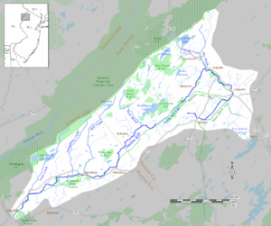
The Paulins Kill drains an area of 177 square miles (460 km2) in northwestern New Jersey and is part of the Delaware River watershed
|
|
The Paulinskill (also known as Lake Paulinskill or Paulinskill River) is a 41.6-mile (66.9 km) tributary of the Delaware River in northwestern New Jersey in the United States. With a long-term median flow rate of 76 cubic feet of water per second (2.15 m³/s), it is New Jersey's third-largest contributor to the Delaware River, behind the Musconetcong River and Maurice River. The Paulinskill drains an area of 176.85 square miles (458.0 km2) across portions of Sussex and Warren counties and 11 municipalities. The Paulinskill flows north from its source near Newton, and then turns southwest. The river sits in the Ridge and Valley geophysical province.
The Paulinskill was a conduit for the emigration of Palatine Germans who settled in northwestern New Jersey and northeastern Pennsylvania during the colonial period and the American Revolution. Remnants of their chiefly agricultural settlements are still found in local architecture, cemeteries, farms and mills, and the area remains largely rural.
Flowing through rural sections of Sussex and Warren counties, the Paulinskill is regarded as an excellent place for fly fishing. The surrounding area is used for hiking and other forms of recreation such as observing birds and other wildlife.
The main branch of the Paulinskill begins to form immediately north of Newton, in the marshes that straddle the town. The headwaters start near Route 622 in Fredon Township. The Paulinskill flows southwest for the rest of its journey, through Hampton and Stillwater townships in Sussex County. Trout Brook, which rises on Kittatinny Mountain, flows into the Paulinskill near Middleville in Stillwater Township. Swartswood Lake feeds Trout Brook through Keen's Mill Brook. The Paulinskill continues its course southwest, entering Warren County, where it initially forms the border between Frelinghuysen and Hardwick townships. It enters Blairstown immediately after, where it is joined by Blair Creek, named (as is the town) for John Insley Blair (1802–1899), as well as Jacksonburg Creek, Susquehanna Creek, Dilts Creek and Walnut Creek. Yards Creek, which rises at the Yards Creek reservoir in Blairstown, enters the Paulins Kill near the hamlet of Hainesburg in Knowlton Township. Finally, in Warren County its waters enter the Delaware River just south of the Delaware Water Gap at the hamlet of Columbia in Knowlton Township.
...
Wikipedia

