Painted Cave Fire
| Painted Cave Fire | |
|---|---|
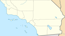
| Location | Santa Ynez Mountains, Santa Barbara County, California |
| Coordinates | 34°30′N 119°47′W / 34.50°N 119.79°WCoordinates: 34°30′N 119°47′W / 34.50°N 119.79°W |
| Statistics | |
| Date(s) | June 27, 1990 – July 2, 1990 |
| Burned area | 5,000 acres (20 km2) |
| Cause | Arson |
| Buildings destroyed |
427 |
| Fatalities | 1 |
| Perpetrator(s) | Leonard Ross |
| Map | |
The Painted Cave Fire was a devastating wildfire that burned in the Santa Ynez Mountains and the city of Santa Barbara, within Santa Barbara County, California.
The fire, which began near Painted Cave, was intentionally set near at the intersection of Highway 154 (San Marcos Pass Road) and Painted Cave Road, burned 5,000 acres (20 km2), destroyed 427 buildings, and killed 1 civilian.
The day had already been a long one for the Santa Barbara County Fire Department which had battled a 3-alarm fire in the county dump. While still mopping up from the dump fire, the call went out at 6:02pm for a brush fire on Highway 154 and Painted Cave Road. On this Wednesday evening temperatures topped off at 109 degrees, an all-time record for that date, fueling some of the worst sundowner winds ever recordered. The first engine arrived on scene at 6:05pm and was met with winds gusting over 40 miles per hour (64 km/h) with about 2 acres (0.81 ha) actively burning. Less than 20 minutes later, the fire had traveled over 2 miles (3.2 km) and flames were reaching 70 feet (21 m) into the air.
The fire proceeded into residential neighborhoods of Santa Barbara, fueled by sundowner winds, eventually jumping U.S. Route 101 at 7:42PM. In less than two hours the fire had traveled nearly 4 miles (6.4 km), destroying 430 structures and killing one person. It was the largest loss of structures since the Bel Air Fire of 1961. The state fire marshal called it the "fastest-moving fire of its type ever in the United States."
The sole fatality of the fire, Andrea Lang Gurka, age 37, died while fleeing the flames along San Marcos Pass Road.
...
Wikipedia

