Ottawa National Wildlife Refuge
| Ottawa National Wildlife Refuge | |
|---|---|
|
IUCN category IV (habitat/species management area)
|
|

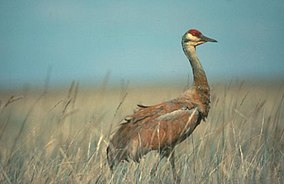
A sandhill crane at the refuge
|
|
|
Map of the United States
|
|
| Location | Lucas, Ottawa counties, Ohio, United States |
| Nearest city | Port Clinton, Ohio |
| Coordinates | 41°36′56″N 83°12′58″W / 41.6156°N 83.21603°WCoordinates: 41°36′56″N 83°12′58″W / 41.6156°N 83.21603°W |
| Area | 6,857.91 acres (27.7530 km2) |
| Established | 1961 |
| Governing body | U.S. Fish and Wildlife Service |
| Website | Ottawa National Wildlife Refuge |
Ottawa National Wildlife Refuge is a National Wildlife Refuge of the United States located in Ohio. This 6,857.91-acre (27.7530 km2) refuge was established in 1961 to preserve habitat for migrating birds.
Staff at the refuge also manage Cedar Point and West Sister Island refuges. The three refuges together now protect approximately 9,000 acres (36 km2) of habitat and some of the last remnants of the Great Black Swamp in the heart of the Lake Erie marshes. This region has historically been important to fish, migratory waterfowl, songbirds, and shorebirds. Large numbers of migrating songbirds stop in the area to rest during their spring migration. Ottawa is an attraction for birdwatching enthusiasts. It is also home to bald eagles. This wildlife refuge has been designated as a site of regional significance in the Western Hemisphere Shorebird Reserve Network. In 2002, Birder's World readers voted the refuge as one of their Top 15 favorite spots to see birds, and the American Bird Conservancy has identified the refuge as an Important Bird Area.
![]() This article incorporates public domain material from websites or documents of the United States Fish and Wildlife Service.
This article incorporates public domain material from websites or documents of the United States Fish and Wildlife Service.
...
Wikipedia

