Otse Hill
| Otse Hill | |
|---|---|
| Highest point | |
| Elevation | 1,491 m (4,892 ft) 1:50,000 scale Botswana government topographic map, trig station |
| Listing | Country high point |
| Coordinates | 25°00′30″S 25°42′57″E / 25.00833°S 25.71583°ECoordinates: 25°00′30″S 25°42′57″E / 25.00833°S 25.71583°E |
| Geography | |
| Location |
Otse, South-East District, Botswana |
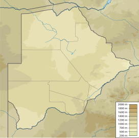
Otse Hill is a peak often cited as the highest point of Botswana, with a reported altitude of 1,491 metres (4,891 feet). It is located in the village of Otse, South-East District. Its highest cell on SRTM data is 1,486 meters - 4875 feet. The 1999 Department of Surveys and Mapping (Gaberone) 1:50,000 scale topographic map shows a "trigonometrical station" on the Otse Peak summit with an elevation of 1,491 meters - 4892 feet.
The Monalanong Hill (at a SRTM-derived altitude of 1,494 metres - 4,902 feet) or the Tsodilo Hills (at an altitude of about 1400 metres - 4,593 feet) are also often given as the highest point in Botswana.
...
Wikipedia

