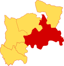
Ossulstone (hundred)
| Ossulstone | |
|---|---|
 |
|
| Area | |
| • 1831 | 47,950 acres (194.0 km2) |
| Population | |
| • 1831 | 1,008,441 |
| • 1881 | 2,205,806 |
| History | |
| • Created | in antiquity |
| Status | hundred |
| Subdivisions | |
| • Type | Divisions / liberties |
Ossulstone was an ancient hundred in the south east of the county of Middlesex, England. Its area has been entirely absorbed by the growth of London; and now corresponds to the part of Inner London that is north of the River Thames and, from Outer London, parts of the London boroughs of Barnet, Brent, Ealing, Haringey and Hounslow.
It was named after "Oswald's Stone" or "Oswulf's Stone", an unmarked pre-Roman monolith which was situated at Tyburn (the modern-day junction of the Edgware Road with Bayswater Road). Oswald's Stone was earthed over in 1819, but dug up three years later because of its presumed historical significance. Later in the 19th century it was to be found leaning against Marble Arch following its move. In 1869, shortly after an archaeological journal published an article about it, the stone disappeared and it has not been identified since.
Within Middlesex, it bordered Edmonton hundred to the north and Elthorne and Gore hundreds to west and north. It bordered the Becontree hundred of Essex to the east, the Blackheath Hundred of Kent to the southeast, and had a short boundary with Hertfordshire to the north. It did not include the City of London, which it surrounded to the west, north and east. Additionally, Westminster formed an independent liberty.
In the 17th century the hundred was split into five divisions, which replaced the hundred for most administrative purposes. These were:
Coordinates: 51°30′46″N 0°9′44″W / 51.51278°N 0.16222°W
...
Wikipedia
