Olkaria
| Olkaria | |
|---|---|

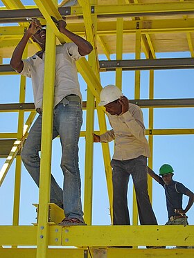
Construction in Olkaria, 2011
|
|
| Highest point | |
| Elevation | 2,434 m (7,986 ft) |
| Coordinates | 0°53′09″S 36°16′12″E / 0.885737°S 36.269989°ECoordinates: 0°53′09″S 36°16′12″E / 0.885737°S 36.269989°E |
| Geography | |
| Location |
|
| Geology | |
| Mountain type | Volcanic complex |
| Last eruption | 1770 ± 50 years |
The Olkaria Area is a region located immediately to the south of Lake Naivasha in the Great Rift Valley of Kenya, Africa. It is geothermally active and is being used to generate growing quantities of clean electrical power. The region has an estimated potential of 2,000 MW. This is almost double the maximum daily electricity peak demand recorded in 2008/2009 for the entire country.
The geothermal complex and power plants lie within the Hell's Gate National Park. The Olkaria volcanic area is about 120 kilometres (75 mi) from Nairobi. It lies south of the Ol Doinyo Eburru complex and north of the Suswa volcano; it is east of the rift valley's western margin and west of Mount Longonot, a stratovolcano. The volcanic field covers 240 square kilometres (93 sq mi).
The largest structure is Olkaria Hill, 2 kilometres (1.2 mi) across and 340 metres (1,120 ft) high. A narrow gorge that crosses the complex with cliffs up to 200 metres (660 ft) high was formed by water flowing out of Lake Naivasha during a period in the past when water levels were much higher than today.
The surface at Olkaria is dominated by a peralkaline rhyolite dome and lava field. The complex contains many centers of volcanic activity that often erupt in small volumes. There are at least eighty such centers of activity, mostly either thick lava flows or steep-sided lava and pyroclastic domes.
Rock from a borehole 1,000 metres (3,300 ft) deep at Olkaria is around 450,000 years old., but the surface features are no more than 20,000 years old. The oldest exposed sequence is the Ol Njorowa pantellerite formation of pyroclastic rocks, lava flows and plugs. This is thought to be related to a caldera 11 kilometres (6.8 mi) by 7.5 kilometres (4.7 mi) that later collapsed but is indicated by traces of a ring fracture. The magma has a wide range of compositions representing the different phases after the caldera collapsed. Although dating is not precise, it seems that the older rocks date to before 9,000 years before present, while the youngest rocks in the Olobutot formation are between 130 and 230 years old.
...
Wikipedia

