Old Oyo National Park
| Old Oyo National Park | |
|---|---|
|
IUCN category II (national park)
|
|
| Location |
Oyo State, |
| Nearest city | Oyo |
| Coordinates | 8°25′0″N 3°50′0″E / 8.41667°N 3.83333°ECoordinates: 8°25′0″N 3°50′0″E / 8.41667°N 3.83333°E |
| Area | 2,512 km2 |
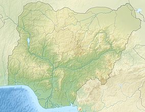
Old Oyo National Park is one of the national parks of Nigeria, located across northern Oyo State and southern Kwara State, Nigeria. The park has total land mass of 2,512 km2 and is located in south west park of Nigeria, specifically northern Oyo State at latitude 8° 15’ and 9° 00’N and longitude 3° 35’ and 4° 42’ E. The location has inevitably placed the park at a vantage position of abundance land area as well as diverse wildlife and cultural/historical settings. Eleven local government areas out of which ten fall within Oyo State and one in Kwara State surround it. The Administrative Head Office is located in Oyo, Isokun area along Oyo-Iseyin road, where necessary information and booking could be made. The landscaping and organized space within the large yard has made the facility very endearing to the public. It is rich in plant and animal resources including buffaloes, bushbuck and a variety of birds. The park is easily accessible from southwestern and northwestern Nigeria. The nearest cities and towns adjoining Old Oyo National Park include Saki, Iseyin, Igboho, Sepeteri, Tede and Igbeti which have their own commercial and cultural attractions for tourism.
The park takes its name from Oyo-lle (Old Oyo), the ancient political capital of Oyo Empire of the Yoruba people, and contains the ruins of this city. Oyo Ile was destroyed in the late 18th century by Ilorin and Hausa/Fulani warriors at the culmination of the rebellion of Afonja, commander of Oyo Empire's provincial army for which he allied himself with Hausa/Fulani Muslim jihadists.
...
Wikipedia

